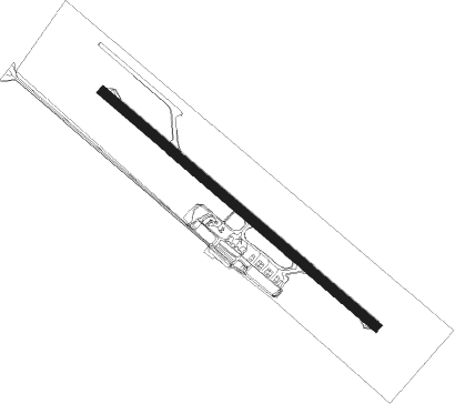
Cascavel
Airport details
| Country | Brazil |
| State | Paraná |
| Region | SB |
| Airspace | Curitiba Ctr |
| Municipality | Cascavel |
| Elevation | 2473ft (754m) |
| Timezone | GMT -3 |
| Coordinates | -25.00222, -53.50195 |
| Magnetic var | |
| Type | land |
| Available since | X-Plane v10.40 |
| ICAO code | SBCA |
| IATA code | CAC |
| FAA code | n/a |
Communication
| Cascavel RDO | 131.850 |
Nearby beacons
| code | identifier | dist | bearing | frequency |
|---|---|---|---|---|
| CAV | CASCAVEL NDB | 0 | 237° | 220 |
| Z | MAYOR D CARLOS EDUARDO KRAUSE NDB | 68.1 | 232° | 310 |
| GAI | GUAIRA NDB | 68.7 | 321° | 305 |
| IGU | CATARATAS DEL IGUAZU VOR/DME | 69.1 | 233° | 114.10 |
Departure and arrival routes
| Transition altitude | 4000ft |
| Transition level | 40ft |
| SID end points | distance | outbound heading | |
|---|---|---|---|
| RW15 | |||
| TEME1B | 76mi | 55° | |
| ROKI1B | 39mi | 130° | |
| VUGL1B | 43mi | 142° | |
| AURI1B | 86mi | 179° | |
| UPOR1B | 65mi | 240° | |
| OMNI | 62mi | 253° | |
| RW33 | |||
| TEME2A | 76mi | 55° | |
| COAN2A | 43mi | 142° | |
| UPOR2A | 65mi | 240° | |
| OMNI | 62mi | 253° | |
Instrument approach procedures
| runway | airway (heading) | route (dist, bearing) |
|---|---|---|
| RW15 | CA003 (164°) | CA003 6000ft CA002 (6mi, 228°) 4500ft |
| RW15 | CA004 (105°) | CA004 6000ft CA002 (6mi, 48°) 4500ft |
| RNAV | CA002 4500ft CA001 (5mi, 132°) 4150ft CA014 (2mi, 132°) 3504ft SBCA (4mi, 134°) 2531ft (3446mi, 65°) 3300ft CA004 (3456mi, 245°) 6000ft CA004 (turn) 6000ft | |
| RW33 | CA007 (312°) | CA007 6000ft CA009 (6mi, 312°) 4500ft |
| RW33 | CA011 (283°) | CA011 6000ft CA009 (6mi, 228°) 4500ft |
| RW33 | CA012 (343°) | CA012 6000ft CA009 (6mi, 48°) 4500ft |
| RNAV | CA009 4500ft CA008 (5mi, 312°) 4100ft CA013 (2mi, 312°) 3461ft SBCA (3mi, 311°) 2506ft (3446mi, 65°) 3300ft CA012 (3447mi, 245°) 6000ft CA012 (turn) 6000ft |
Disclaimer
The information on this website is not for real aviation. Use this data with the X-Plane flight simulator only! Data taken with kind consent from X-Plane 12 source code and data files. Content is subject to change without notice.
