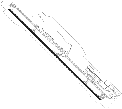
Belo Horizonte - Tancredo Neves
Airport details
| Country | Brazil |
| State | Minas Gerais |
| Region | SB |
| Airspace | Brasilia Ctr |
| Municipality | Confins |
| Elevation | 2712ft (827m) |
| Timezone | GMT -3 |
| Coordinates | -19.62444, -43.97194 |
| Magnetic var | |
| Type | land |
| Available since | X-Plane v10.40 |
| ICAO code | SBCF |
| IATA code | CNF |
| FAA code | n/a |
Communication
| Tancredo Neves BELO HORIZONTE ATIS | 127.450 |
| Tancredo Neves CONFINS Clearance DEL | 121.000 |
| Tancredo Neves Ground Control | 121.900 |
| Tancredo Neves CONFINS Tower | 118.200 |
| Tancredo Neves BELO HORIZONTE Approach | 119.650 |
| Tancredo Neves BELO HORIZONTE Approach | 120.200 |
| Tancredo Neves BELO HORIZONTE Approach | 129.100 |
| Tancredo Neves BELO HORIZONTE Approach | 129.400 |
Approach frequencies
| ILS-cat-I | RW16 | 109.7 | 18.00mi |
| ILS-cat-I | RW34 | 110.3 | 18.00mi |
| 3° GS | RW16 | 109.7 | 18.00mi |
| 3° GS | RW34 | 110.3 | 18.00mi |
Nearby beacons
| code | identifier | dist | bearing | frequency |
|---|---|---|---|---|
| LST | LAGOA SANTA NDB | 4.7 | 115° | 295 |
| CNF | CONFINS (BELO HORIZONTE) VOR/DME | 5.8 | 311° | 114.40 |
| BHZ | BELO HORIZONTE VOR/DME | 12.8 | 189° | 117.70 |
| PMI | DE MINAS DME | 38.2 | 251° | 113.70 |
| CVO | DME | 59.3 | 331° | 113.40 |
Departure and arrival routes
| Transition altitude | 8000ft |
| Transition level | 8000ft |
| SID end points | distance | outbound heading | |
|---|---|---|---|
| RW16 | |||
| SINE1A, ISNU1A | 84mi | 84° | |
| KUBE1A | 60mi | 109° | |
| MUGR1B, ISLE1A | 40mi | 265° | |
| SUBR1A, TORU1A | 39mi | 326° | |
| RW34 | |||
| SINE1A, GATO1A | 84mi | 84° | |
| IRAX1A | 60mi | 109° | |
| MUGR1A, AKRA1A | 40mi | 265° | |
| SUBR1B, TORU1A | 39mi | 326° | |
| STAR starting points | distance | inbound heading | |
|---|---|---|---|
| RW16 | |||
| ISVA1A | 49.5 | 37° | |
| GILN1A | 50.0 | 119° | |
| EPDI1A | 50.5 | 215° | |
| KIMU1A | 23.8 | 303° | |
| RW34 | |||
| ISVA1A | 49.5 | 37° | |
| GILN1A | 50.0 | 119° | |
| EPDI1A | 50.5 | 215° | |
| KIMU1A | 23.8 | 303° | |
Instrument approach procedures
| runway | airway (heading) | route (dist, bearing) |
|---|---|---|
| RW16-Y | AKPUV (167°) | AKPUV 7000ft UGTES (6mi, 230°) 5000ft |
| RW16-Y | OSOMI (136°) | OSOMI 7000ft UGTES (5mi, 137°) 5000ft |
| RW16-Y | TISLO (107°) | TISLO 7000ft UGTES (6mi, 50°) 5000ft |
| RNAV | UGTES 5000ft CF012 (5mi, 137°) 4540ft CF016 (6mi, 137°) 2761ft (2842mi, 66°) 4700ft CF039 (2836mi, 246°) 7000ft CF039 (turn) 7000ft | |
| RW16 | AKPUV (167°) | AKPUV 7000ft UGTES (6mi, 230°) 5000ft |
| RW16 | OSOMI (136°) | OSOMI 7000ft UGTES (5mi, 137°) 5000ft |
| RW16 | TISLO (107°) | TISLO 7000ft UGTES (6mi, 50°) 5000ft |
| RNAV | UGTES 5000ft CF012 (5mi, 137°) 4400ft SBCF (5mi, 135°) 2762ft (2842mi, 66°) 4700ft CF039 (2836mi, 246°) 7000ft CF039 (turn) 7000ft | |
| RW34-Z | KUGUT (291°) | KUGUT 7000ft NIGRI (6mi, 230°) 5600ft |
| RW34-Z | VADON (318°) | VADON 7000ft NIGRI (3mi, 317°) 5600ft |
| RNAV | NIGRI 5600ft KUMEV (5mi, 317°) 4270ft CF049 (3mi, 317°) 3217ft SBCF (3mi, 322°) 2771ft (2842mi, 66°) 4700ft KUGUT (2832mi, 246°) 7000ft KUGUT (turn) 7000ft |
Holding patterns
| STAR name | hold at | type | turn | heading* | altitude | leg | speed limit |
|---|---|---|---|---|---|---|---|
| EPDI1A | CF033 | VHF | left | 70 (250)° | 1.0min timed | ICAO rules | |
| GILN1A | WH009 | VHF | left | 312 (132)° | 1.0min timed | ICAO rules | |
| ISVA1A | CF042 | VHF | left | 224 (44)° | 1.0min timed | ICAO rules | |
| KIMU1A | KIMUS | VHF | right | 162 (342)° | 1.0min timed | ICAO rules | |
| *) magnetic outbound (inbound) holding course | |||||||
Disclaimer
The information on this website is not for real aviation. Use this data with the X-Plane flight simulator only! Data taken with kind consent from X-Plane 12 source code and data files. Content is subject to change without notice.
