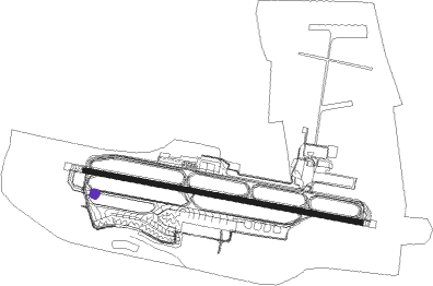
Fortaleza - Fortaleza Pinto Martins Intl
Airport details
| Country | Brazil |
| State | Ceará |
| Region | SB |
| Airspace | Recife Ctr |
| Municipality | Fortaleza |
| Elevation | 82ft (25m) |
| Timezone | GMT -3 |
| Coordinates | -3.77583, -38.53222 |
| Magnetic var | |
| Type | land |
| Available since | X-Plane v10.40 |
| ICAO code | SBFZ |
| IATA code | FOR |
| FAA code | n/a |
Communication
| Fortaleza Pinto Martins Intl ATIS | 127.700 |
| Fortaleza Pinto Martins Intl Ground Control | 121.950 |
| Fortaleza Pinto Martins Intl FORTALEZA Tower | 129.000 |
| Fortaleza Pinto Martins Intl FORTALEZA Tower | 118.500 |
| Fortaleza Pinto Martins Intl FORTALEZA Approach | 119.200 |
| Fortaleza Pinto Martins Intl FORTALEZA Approach | 133.000 |
| Fortaleza Pinto Martins Intl FORTALEZA Approach | 134.550 |
Approach frequencies
| ILS-cat-I | RW13 | 109.3 | 18.00mi |
| 3° GS | RW13 | 109.3 | 18.00mi |
Nearby beacons
| code | identifier | dist | bearing | frequency |
|---|---|---|---|---|
| FLZ | FORTALEZA VOR/DME | 0.9 | 283° | 114.10 |
Departure and arrival routes
| Transition altitude | 5000ft |
| Transition level | 45ft |
| SID end points | distance | outbound heading | |
|---|---|---|---|
| RW13 | |||
| BOBA1A, BOBA1B | 39mi | 123° | |
| DIANA, KUGUS | 39mi | 141° | |
| EGBOL, FLZ1B | 40mi | 178° | |
| LOGI1A | 60mi | 179° | |
| IRUR1B, IRUR1A | 71mi | 253° | |
| FLZ1D | 41mi | 254° | |
| ISUP1A | 122mi | 282° | |
| RW31 | |||
| BOBA1B, BOBA1A | 39mi | 123° | |
| DIAN1A, DIANA, KUGUS | 39mi | 141° | |
| EGBOL, FLZ1C | 40mi | 178° | |
| PRAX1B | 60mi | 179° | |
| EDVA1B | 168mi | 195° | |
| ABUC1B | 61mi | 217° | |
| SISA1A | 71mi | 253° | |
| ISTO1A | 41mi | 254° | |
| ESAV1A | 55mi | 283° | |
Instrument approach procedures
| runway | airway (heading) | route (dist, bearing) |
|---|---|---|
| RW13 | FZ004 (105°) | FZ004 5000ft FZ001 (6mi, 105°) 3200ft |
| RW13 | FZ006 (129°) | FZ006 5000ft FZ001 (6mi, 175°) 3200ft |
| RW13 | FZ007 (81°) | FZ007 5000ft FZ001 (6mi, 35°) 3200ft |
| RNAV | FZ001 3200ft FZ002 (5mi, 105°) 1720ft FZ008 (3mi, 105°) 830ft SBFZ (3mi, 104°) 132ft FZ381 (19mi, 105°) 5000ft FZ381 (turn) 5000ft | |
| RW31 | FZ379 (306°) | FZ379 5000ft FZ383 (6mi, 355°) 3200ft |
| RW31 | FZ381 (285°) | FZ381 5000ft FZ383 (6mi, 285°) 3200ft |
| RW31 | FZ382 (264°) | FZ382 5000ft FZ383 (6mi, 215°) 3200ft |
| RNAV | FZ383 3200ft FZ384 (6mi, 285°) 2020ft SBFZ (7mi, 285°) 115ft FZ374 (19mi, 285°) 5000ft FZ374 (turn) 5000ft |
Disclaimer
The information on this website is not for real aviation. Use this data with the X-Plane flight simulator only! Data taken with kind consent from X-Plane 12 source code and data files. Content is subject to change without notice.
