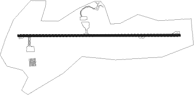
Sao Roque - Sao Paulo Catarina Executivo
Airport details
| Country | Brazil |
| State | São Paulo |
| Region | SB |
| Airspace | Curitiba Ctr |
| Municipality | São Roque |
| Elevation | 2548ft (777m) |
| Timezone | GMT -3 |
| Coordinates | -23.42682, -47.16592 |
| Magnetic var | |
| Type | land |
| Available since | X-Plane v11.50 |
| ICAO code | SBJH |
| IATA code | n/a |
| FAA code | n/a |
Communication
Nearby Points of Interest:
Mairinque station
-Figueira Centenária
-Serra do Japi
-House at Sítio do Mandu
-House at Sítio do Padre Inácio
-Biblioteca Municipal Nelson Foot
-Loja Maçônica Amor e Concórdia
-Gabinete de Leitura Ruy Barbosa
-Solar do Barão de Jundiaí
-Complexo FEPASA
-Jaraguá State Park
-Brazilian Portland Cement
-Perus train station
-Juqueri Psychiatric Hospital
-Franco da Rocha train station
-Freguesia do Ó
-Sertanista house
-Tendal da Lapa
-Edifício da Sociedade Beneficente União Fraterna
-Casa da Fazenda do Morumbi
-Monumento à Aldeia de Nossa Senhora dos Pinheiros
-Chácara Tangará
-Jockey Club de São Paulo
-Antiga Sede da TV Tupi
-Reservatório do Araçá
Nearby beacons
| code | identifier | dist | bearing | frequency |
|---|---|---|---|---|
| SCB | SOROCABA (SAO PAULO TMA) VOR/DME | 12.6 | 249° | 115.20 |
| STN | SANTANA (SAO PAULO TMA) VOR/DME | 13.8 | 104° | 114.30 |
| CPN | CAMPINAS VOR/DME | 25.1 | 5° | 112 |
| IK | BENTO (CAMPINAS) NDB | 28.2 | 355° | 370 |
| CGO | CONGONHAS (SAO PAULO) VOR/DME | 30.6 | 111° | 116.90 |
| EMB | EMBUGUACU (SAO PAULO) NDB | 31.9 | 140° | 525 |
| IG | TUCA (SAO PAULO) NDB | 32.7 | 93° | 410 |
| DAD | DIADEMA (SAO PAULO) NDB | 35.3 | 116° | 200 |
| BCO | BONSUCESSO (SAO PAULO) VOR/DME | 43 | 89° | 116 |
| BGC | BRAGANCA (BRAGANCA PAULIS VOR/DME | 43.5 | 51° | 116.20 |
| RDE | REDE (SAO PAULO) VOR/DME | 44.8 | 126° | 116.70 |
| RCL | RIO CLARO NDB | 63.7 | 338° | 280 |
Departure and arrival routes
| SID end points | distance | outbound heading | |
|---|---|---|---|
| RW12 | |||
| OMNI | 28mi | 207° | |
| RW30 | |||
| OMNI | 28mi | 207° | |
Instrument approach procedures
| runway | airway (heading) | route (dist, bearing) |
|---|---|---|
| RW12 | JH003 (94°) | JH003 6000ft JH002 (6mi, 94°) 4500ft |
| RW12 | JH004 (117°) | JH004 6000ft JH002 (5mi, 163°) 4500ft |
| RNAV | JH002 4500ft JH001 (4mi, 94°) 3870ft JH006 (2mi, 94°) 3234ft SBJH (3mi, 94°) 2597ft (3087mi, 64°) 3100ft JH004 (3095mi, 244°) 6000ft JH004 (turn) 6000ft | |
| RW30-Y | JH019 (21°) | JH019 6000ft JH021 (5mi, 94°) 5000ft JH022 (6mi, 45°) 4500ft JH024 (2mi, 333°) 4100ft |
| RNAV | JH024 4100ft JH026 (2mi, 295°) 3590ft SBJH (4mi, 274°) 2564ft JH016 (6mi, 274°) JH017 (7mi, 310°) 6000ft JH017 (turn) 6000ft | |
| RW30-Z | JH011 (33°) | JH011 6000ft JH012 (5mi, 94°) 4700ft |
| RNAV | JH012 4700ft JH013 (5mi, 37°) 4160ft JH014 (3mi, 302°) 3201ft SBJH (3mi, 274°) 2564ft JH016 (6mi, 274°) JH017 (7mi, 310°) JH017 (turn) 6000ft |
Disclaimer
The information on this website is not for real aviation. Use this data with the X-Plane flight simulator only! Data taken with kind consent from X-Plane 12 source code and data files. Content is subject to change without notice.