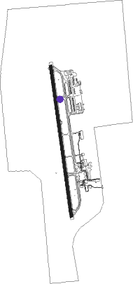
Porto Velho - Porto Velho Intl
Airport details
| Country | Brazil |
| State | Rondônia |
| Region | SB |
| Airspace | Amazonica Ctr |
| Municipality | Porto Velho |
| Elevation | 291ft (89m) |
| Timezone | GMT -4 |
| Coordinates | -8.71361, -63.90278 |
| Magnetic var | |
| Type | land |
| Available since | X-Plane v10.40 |
| ICAO code | SBPV |
| IATA code | PVH |
| FAA code | n/a |
Communication
| Porto Velho Intl Tower | 118.700 |
| Porto Velho Intl Approach | 119.100 |
Approach frequencies
| ILS-cat-I | RW19 | 109.3 | 18.00mi |
| 3° GS | RW19 | 109.3 | 18.00mi |
Nearby beacons
| code | identifier | dist | bearing | frequency |
|---|---|---|---|---|
| PVH | PORTO VELHO VOR/DME | 0 | 239° | 112.70 |
Departure and arrival routes
| Transition altitude | 3000ft |
| Transition level | 30ft |
| SID end points | distance | outbound heading | |
|---|---|---|---|
| RW01 | |||
| MUPE2A, MUPE3A | 33mi | 34° | |
| ISUR2A, ISUR3A | 40mi | 42° | |
| ANBU1A | 145mi | 112° | |
| PVH1A | 40mi | 112° | |
| ITAG2A | 40mi | 138° | |
| GUIM2A | 40mi | 214° | |
| OSAT2A | 39mi | 253° | |
| ANAM1A, ANAM1C | 40mi | 254° | |
| OGLA2A | 40mi | 305° | |
| NELI3A, NELI2A | 40mi | 340° | |
| RW19 | |||
| MUPE1C | 33mi | 34° | |
| ISUR3B | 40mi | 42° | |
| KOGV3B | 40mi | 112° | |
| ILTA1B | 145mi | 112° | |
| ITAG3B, ITAG2B | 40mi | 138° | |
| DIKA3B, DIKA2B | 53mi | 142° | |
| ILSO2B, ILSO3B | 41mi | 154° | |
| GUIM3B, GUIM2B | 40mi | 214° | |
| OSAT2B | 39mi | 253° | |
| ANAM1B, ANAM1D | 40mi | 254° | |
| OGLA2B | 40mi | 305° | |
| NELI2B, PVH1B | 40mi | 340° | |
Instrument approach procedures
| runway | airway (heading) | route (dist, bearing) |
|---|---|---|
| RW01-Y | PV381 (356°) | PV381 3000ft PV369 (6mi, 357°) 2000ft |
| RW01-Y | PV382 (332°) | PV382 3000ft PV369 (6mi, 286°) 2000ft |
| RW01-Y | PV383 (21°) | PV383 3000ft PV369 (6mi, 67°) 2000ft |
| RNAV | PV369 2000ft PV378 (5mi, 357°) 1930ft PVH12 (3mi, 357°) 1037ft SBPV (3mi, 356°) 337ft (3857mi, 82°) 3000ft (turn) 3000ft | |
| RW01-Z | PV381 (356°) | PV381 3000ft PV369 (6mi, 357°) 2000ft |
| RW01-Z | PV382 (332°) | PV382 3000ft PV369 (6mi, 286°) 2000ft |
| RW01-Z | PV383 (21°) | PV383 3000ft PV369 (6mi, 67°) 2000ft |
| RNAV | PV369 2000ft PV378 (5mi, 357°) 1930ft PVH12 (3mi, 357°) 1038ft SBPV (3mi, 356°) 337ft PV003 (17mi, 357°) 3000ft PV003 (turn) 3000ft | |
| RW19-Y | PV001 (148°) | PV001 3000ft ASBOS (6mi, 87°) 2000ft |
| RW19-Y | PV002 (206°) | PV002 3000ft ASBOS (6mi, 267°) 2000ft |
| RW19-Y | PV003 (177°) | PV003 3000ft ASBOS (6mi, 177°) 2000ft |
| RNAV | ASBOS 2000ft DETOK (5mi, 177°) 1930ft PVH11 (3mi, 177°) 1024ft SBPV (3mi, 177°) 337ft (3857mi, 82°) 3000ft (turn) 3000ft | |
| RW19-Z | PV001 (148°) | PV001 3000ft ASBOS (6mi, 87°) 2000ft |
| RW19-Z | PV002 (206°) | PV002 3000ft ASBOS (6mi, 267°) 2000ft |
| RW19-Z | PV003 (177°) | PV003 3000ft ASBOS (6mi, 177°) 2000ft |
| RNAV | ASBOS 2000ft DETOK (5mi, 177°) 1930ft PVH11 (3mi, 177°) 1025ft SBPV (3mi, 177°) 337ft PV381 (16mi, 176°) 3000ft PV381 (turn) 3000ft |
Disclaimer
The information on this website is not for real aviation. Use this data with the X-Plane flight simulator only! Data taken with kind consent from X-Plane 12 source code and data files. Content is subject to change without notice.