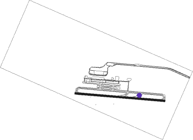
Natal - Natal International Airport
Airport details
| Country | Brazil |
| State | Rio Grande do Norte |
| Region | SB |
| Airspace | Recife Ctr |
| Municipality | São Gonçalo do Amarante |
| Elevation | 288ft (88m) |
| Timezone | GMT -3 |
| Coordinates | -5.76889, -35.36639 |
| Magnetic var | |
| Type | land |
| Available since | X-Plane v11.05 |
| ICAO code | SBSG |
| IATA code | NAT |
| FAA code | NAT |
Communication
| Natal International Airport ATIS | 127.600 |
| Natal International Airport CLRD | 121.000 |
| Natal International Airport Ground ControlC | 121.700 |
| Natal International Airport Tower | 118.200 |
Approach frequencies
| ILS-cat-I | RW12 | 109.7 | 18.00mi |
| 3° GS | RW12 | 109.7 | 18.00mi |
Nearby beacons
| code | identifier | dist | bearing | frequency |
|---|---|---|---|---|
| SGA | SAO GONCALO DO AMARANTE VOR/DME | 0.2 | 218° | 115.90 |
| NTL | NATAL VOR/DME | 10.9 | 140° | 114.30 |
| MXN | MAXARANGUAPE (NATAL TMA) NDB | 25 | 337° | 205 |
Departure and arrival routes
| Transition altitude | 5000ft |
| Transition level | 50ft |
| SID end points | distance | outbound heading | |
|---|---|---|---|
| RW12 | |||
| BUVO1A, GIDM1A | 37mi | 44° | |
| AMVU1B | 71mi | 181° | |
| NTL1A | 81mi | 200° | |
| AMVU1C | 124mi | 203° | |
| NEBI1A | 30mi | 298° | |
| LOKI1B | 60mi | 300° | |
| RW30 | |||
| BUVO1B | 37mi | 44° | |
| DABL1A | 85mi | 197° | |
| NTL1B | 81mi | 200° | |
| NEBI1B | 30mi | 298° | |
| STAR starting points | distance | inbound heading | |
|---|---|---|---|
| RW12 | |||
| VACA1D, VACA1G | 123.5 | 23° | |
| DADP1A | 85.0 | 121° | |
Instrument approach procedures
| runway | airway (heading) | route (dist, bearing) |
|---|---|---|
| RW12 | IVSIK (70°) | IVSIK 4000ft ESEDO (6mi, 9°) 3000ft |
| RW12 | KUBTO (99°) | KUBTO 4000ft ESEDO (6mi, 99°) 3000ft |
| RW12 | NIMPI (128°) | NIMPI 4000ft ESEDO (6mi, 190°) 3000ft |
| RNAV | ESEDO 3000ft DONRA (5mi, 99°) 1920ft SG002 (4mi, 99°) 766ft SBSG (2mi, 98°) 320ft (2148mi, 81°) 1500ft NIMPI (2157mi, 261°) 4000ft NIMPI (turn) 4000ft | |
| RW30 | UKBUS (250°) | UKBUS 4000ft SUBMO (6mi, 190°) 3000ft |
| RW30 | VOVRI (279°) | VOVRI 4000ft SUBMO (6mi, 279°) 3000ft |
| RW30 | VUMEN (309°) | VUMEN 4000ft SUBMO (6mi, 8°) 3000ft |
| RNAV | SUBMO 3000ft OPREK (5mi, 279°) 1910ft SBSG (6mi, 280°) 311ft (2148mi, 81°) 1500ft UKBUS (2136mi, 261°) 4000ft UKBUS (turn) 4000ft |
Holding patterns
| STAR name | hold at | type | turn | heading* | altitude | leg | speed limit |
|---|---|---|---|---|---|---|---|
| DADP1A | ASIRO | VHF | right | 339 (159)° | 1.0min timed | ICAO rules | |
| DADP1A | KUBTO | VHF | right | 320 (140)° | 1.0min timed | ICAO rules | |
| VACA1D | NEBUG | VHF | right | 166 (346)° | 1.0min timed | ICAO rules | |
| VACA1D | SEVIL | VHF | left | 229 (49)° | 1.5min timed | ICAO rules | |
| VACA1G | ARPUK | VHF | left | 216 (36)° | 1.5min timed | ICAO rules | |
| VACA1G | BIVIV | VHF | left | 216 (36)° | 1.0min timed | ICAO rules | |
| *) magnetic outbound (inbound) holding course | |||||||
Disclaimer
The information on this website is not for real aviation. Use this data with the X-Plane flight simulator only! Data taken with kind consent from X-Plane 12 source code and data files. Content is subject to change without notice.
