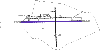
Santa Maria
Airport details
| Country | Brazil |
| State | Rio Grande do Sul |
| Region | SB |
| Airspace | Curitiba Ctr |
| Municipality | Santa Maria |
| Elevation | 287ft (87m) |
| Timezone | GMT -3 |
| Coordinates | -29.71083, -53.69222 |
| Magnetic var | |
| Type | land |
| Available since | X-Plane v10.40 |
| ICAO code | SBSM |
| IATA code | RIA |
| FAA code | n/a |
Communication
| Santa Maria Tower | 118.850 |
| Santa Maria Tower | 118.300 |
| Santa Maria Approach | 119.350 |
| Santa Maria Approach | 121.350 |
Approach frequencies
| ILS-cat-I | RW11 | 110.3 | 18.00mi |
| 3° GS | RW11 | 110.3 | 18.00mi |
Nearby beacons
| code | identifier | dist | bearing | frequency |
|---|---|---|---|---|
| SMA | SANTA MARIA VOR/DME | 1 | 273° | 112 |
| CAT | CRUZ ALTA NDB | 59.5 | 3° | 335 |
Departure and arrival routes
| Transition altitude | 4000ft |
| SID end points | distance | outbound heading | |
|---|---|---|---|
| RW11 | |||
| ALBA1B | 104mi | 44° | |
| SMA1B | 14mi | 46° | |
| TOPI1B | 53mi | 69° | |
| KEKA1C, KEKA1D | 39mi | 93° | |
| IMPE1C, IMPE1D | 39mi | 97° | |
| POXE1A | 39mi | 159° | |
| BGE1B | 103mi | 194° | |
| GUXA1B | 29mi | 232° | |
| OMNI | 11mi | 273° | |
| RAXE1C, RAXE1D, IBDO1A | 41mi | 281° | |
| ISLI1B | 53mi | 349° | |
| RW20 | |||
| BGE1B | 103mi | 194° | |
| GUXA1B | 29mi | 232° | |
| OMNI | 11mi | 273° | |
| RAXE1D | 41mi | 281° | |
| RW29 | |||
| ALBA2A | 104mi | 44° | |
| SMA2A | 14mi | 46° | |
| TOPI2A | 53mi | 69° | |
| KEKA2B, KEKA2A | 39mi | 93° | |
| IMPE2B, IMPE2A | 39mi | 97° | |
| POXE1B | 39mi | 159° | |
| BGE1C, BGE1B, BGE1A | 103mi | 194° | |
| GUXA2A, GUXA1B | 29mi | 232° | |
| OMNI | 11mi | 273° | |
| RAXE2B, RAXE2A, RAXE1D | 41mi | 281° | |
| ISLI2A | 53mi | 349° | |
| STAR starting points | distance | inbound heading | |
|---|---|---|---|
| RW11 | |||
| RAXE1A | 41.0 | 101° | |
| GEGA1A | 55.0 | 253° | |
| KEKA1A | 38.8 | 273° | |
| IMPE1A | 38.8 | 277° | |
| RW29 | |||
| RAXE1B | 41.0 | 101° | |
| GEGA1B | 55.0 | 253° | |
| KEKA1B | 38.8 | 273° | |
Instrument approach procedures
| runway | airway (heading) | route (dist, bearing) |
|---|---|---|
| RW11 | SM001 (93°) | SM001 5000ft SM004 (6mi, 93°) 3000ft |
| RW11 | SM002 (114°) | SM002 5000ft SM004 (6mi, 161°) 3000ft |
| RW11 | SM003 (72°) | SM003 5000ft SM004 (6mi, 27°) 3000ft |
| RNAV | SM004 3000ft ULVUD (5mi, 93°) 1930ft SM021 (2mi, 93°) 1293ft SM022 (turn) 1006ft SBSM (3mi, 93°) 338ft (3546mi, 61°) 800ft SM017 (3541mi, 241°) 5000ft SM017 (turn) 5000ft | |
| RW29 | SM008 (273°) | SM008 5000ft SM011 (6mi, 273°) 3500ft |
| RW29 | SM009 (295°) | SM009 5000ft SM011 (6mi, 4°) 3500ft |
| RW29 | SM012 (251°) | SM012 5000ft SM011 (6mi, 184°) 3500ft |
| RNAV | SM011 3500ft SM013 (6mi, 273°) 2510ft SM018 (2mi, 273°) 1677ft SM019 (2mi, 273°) 1027ft SBSM (3mi, 273°) 306ft (3546mi, 61°) 800ft SM009 (3537mi, 241°) 5000ft SM009 (turn) 5000ft |
Holding patterns
| STAR name | hold at | type | turn | heading* | altitude | leg | speed limit |
|---|---|---|---|---|---|---|---|
| GEGA1A | SM016 | VHF | right | 108 (288)° | 1.0min timed | ICAO rules | |
| GEGA1B | SM012 | VHF | right | 288 (108)° | 1.0min timed | ICAO rules | |
| IMPE1A | SM014 | VHF | left | 109 (289)° | 1.0min timed | ICAO rules | |
| KEKA1A | SM016 | VHF | right | 108 (288)° | 1.0min timed | ICAO rules | |
| KEKA1B | SM008 | VHF | right | 109 (289)° | 1.0min timed | ICAO rules | |
| RAXE1A | SM001 | VHF | right | 289 (109)° | 1.0min timed | ICAO rules | |
| RAXE1B | SM012 | VHF | right | 288 (108)° | 1.0min timed | ICAO rules | |
| *) magnetic outbound (inbound) holding course | |||||||
Disclaimer
The information on this website is not for real aviation. Use this data with the X-Plane flight simulator only! Data taken with kind consent from X-Plane 12 source code and data files. Content is subject to change without notice.

