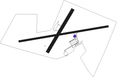
Uruguaiana - Rubem Berta
Airport details
| Country | Brazil |
| State | Rio Grande do Sul |
| Region | SB |
| Airspace | Curitiba Ctr |
| Municipality | Uruguaiana |
| Elevation | 254ft (77m) |
| Timezone | GMT -3 |
| Coordinates | -29.78194, -57.03833 |
| Magnetic var | |
| Type | land |
| Available since | X-Plane v10.40 |
| ICAO code | SBUG |
| IATA code | URG |
| FAA code | n/a |
Communication
| Rubem Berta URUGUAIANA RDO | 118.100 |
| Rubem Berta URUGUAIANA RDO | 125.900 |
Nearby beacons
| code | identifier | dist | bearing | frequency |
|---|---|---|---|---|
| URG | URUGUAIANA NDB | 0.2 | 157° | 275 |
| LIB | PASO DE LOS LIBRES NDB | 7.7 | 308° | 250 |
| L | PASO DE LOS LIBRES NDB | 9.1 | 314° | 325 |
| MCS | MONTE CASEROS VOR/DME | 42.6 | 231° | 113.90 |
Departure and arrival routes
| Transition altitude | 3000ft |
| Transition level | 30ft |
| SID end points | distance | outbound heading | |
|---|---|---|---|
| RW09 | |||
| BLIN2A | 21mi | 74° | |
| ILVE1A | 82mi | 74° | |
| RW27 | |||
| BLIN2B | 21mi | 74° | |
| ILVE1B | 82mi | 74° | |
Instrument approach procedures
| runway | airway (heading) | route (dist, bearing) |
|---|---|---|
| RW27-Z | UG004 (287°) | UG004 3000ft UG003 (6mi, 332°) 2000ft |
| RW27-Z | UG006 (244°) | UG006 3000ft UG003 (6mi, 197°) 2000ft |
| RW27-Z | UG007 (265°) | UG007 3000ft UG003 (6mi, 265°) 2000ft |
| RNAV | UG003 2000ft UG001 (5mi, 265°) 1883ft SDF27 (3mi, 265°) 700ft SBUG (2mi, 266°) 279ft UG002 (3mi, 265°) UG009 (7mi, 146°) 3000ft UG009 (turn) 3000ft |
Disclaimer
The information on this website is not for real aviation. Use this data with the X-Plane flight simulator only! Data taken with kind consent from X-Plane 12 source code and data files. Content is subject to change without notice.

