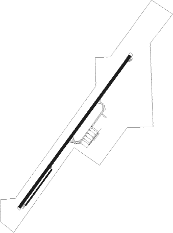
Ciudad Del Este - Guarani
Airport details
| Country | Paraguay |
| State | Alto Paraná |
| Region | SG |
| Airspace | Asuncion Ctr |
| Municipality | Minga Guazú |
| Elevation | 846ft (258m) |
| Timezone | GMT -4 |
| Coordinates | -25.45529, -54.84177 |
| Magnetic var | |
| Type | land |
| Available since | X-Plane v10.40 |
| ICAO code | SGES |
| IATA code | AGT |
| FAA code | n/a |
Communication
| Guarani Ground Control | 121.700 |
| Guarani Tower | 118.100 |
| Guarani Approach | 119.300 |
| Guarani Approach | 120.600 |
Approach frequencies
| ILS-cat-I | RW23 | 111.3 | 18.00mi |
| 3° GS | RW23 | 111.3 | 18.00mi |
Nearby beacons
| code | identifier | dist | bearing | frequency |
|---|---|---|---|---|
| VES | MINGA GUAZU VOR/DME | 0.5 | 240° | 116.30 |
| CDE | CIUDAD DEL ESTE NDB | 1.9 | 225° | 200 |
| ALG | CIUDAD DEL ESTE NDB | 6.8 | 43° | 293 |
| ITU | ITAIPU NDB | 12.2 | 78° | 225 |
| FOZ | FOZ (FOZ DO IGUACU) VOR/DME | 19.8 | 111° | 112.10 |
| IGU | CATARATAS DEL IGUAZU VOR/DME | 25.5 | 128° | 114.10 |
| Z | MAYOR D CARLOS EDUARDO KRAUSE NDB | 27.6 | 127° | 310 |
Departure and arrival routes
| Transition altitude | 3000ft |
| SID end points | distance | outbound heading | |
|---|---|---|---|
| RW05 | |||
| MATEL | 54mi | 76° | |
| KAMIL | 59mi | 97° | |
| ALDOS | 47mi | 169° | |
| DAGOL | 41mi | 188° | |
| COSTA | 22mi | 262° | |
| RW23 | |||
| MATEL | 54mi | 76° | |
| KAMIL | 59mi | 97° | |
| ALDOS | 47mi | 169° | |
| DAGOL | 41mi | 188° | |
| COSTA | 22mi | 262° | |
Instrument approach procedures
| runway | airway (heading) | route (dist, bearing) |
|---|---|---|
| RW05-Z | ILNIS (65°) | ILNIS 3000ft NINDA (5mi, 109°) 2500ft |
| RW05-Z | IROKO (21°) | IROKO 3000ft NINDA (5mi, 328°) 2500ft |
| RW05-Z | PULMI (44°) | PULMI 3000ft NINDA (5mi, 44°) 2500ft |
| RNAV | NINDA 2500ft GILMO (4mi, 44°) 2490ft SGES (6mi, 44°) 896ft (3524mi, 65°) 3000ft KORDI (3511mi, 245°) KORDI (turn) | |
| RW23-Z | KORDI (223°) | KORDI 3000ft ROGER (5mi, 223°) 2500ft |
| RW23-Z | SATMO (200°) | SATMO 3000ft ROGER (5mi, 148°) 2500ft |
| RW23-Z | TEROM (245°) | TEROM 3000ft ROGER (5mi, 289°) 2500ft |
| RNAV | ROGER 2500ft MOLMA (4mi, 224°) 2420ft SGES (6mi, 223°) 824ft (3524mi, 65°) 3000ft PULMI (3536mi, 245°) PULMI (turn) |
Disclaimer
The information on this website is not for real aviation. Use this data with the X-Plane flight simulator only! Data taken with kind consent from X-Plane 12 source code and data files. Content is subject to change without notice.

