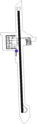
Cartagena - Rafael Nuñez Intl
Airport details
| Country | Colombia |
| State | Bolívar |
| Region | SK |
| Airspace | Barranquilla Ctr |
| Municipality | Cartagena |
| Elevation | 0ft (0m) |
| Timezone | GMT -5 |
| Coordinates | 10.44204, -75.51278 |
| Magnetic var | |
| Type | land |
| Available since | X-Plane v10.40 |
| ICAO code | SKCG |
| IATA code | CTG |
| FAA code | n/a |
Communication
| Rafael Nuñez Intl ATIS | 113.850 |
| Rafael Nuñez Intl MET | 127.650 |
| Rafael Nuñez Intl Rafael Nuñez Clearence | 118.300 |
| Rafael Nuñez Intl Rafael Nuñez Tower | 120.300 |
| Rafael Nuñez Intl BARRANQUILLA Approach | 119.100 |
Approach frequencies
| ILS-cat-I | RW01 | 111.3 | 18.00mi |
| 3° GS | RW01 | 111.3 | 18.00mi |
Nearby Points of Interest:
Port, Fortresses and Group of Monuments, Cartagena
-Teatro Heredia
-Castle of San Luis de Bocachica
-Canal del Dique
-San Basilio de Palenque
-Museum of Poet Julio Florez
Nearby beacons
| code | identifier | dist | bearing | frequency |
|---|---|---|---|---|
| CT | CARTAGENA NDB | 2.7 | 182° | 255 |
| CTG | CARTAGENA VOR/DME | 14 | 178° | 112.30 |
| BAQ | BARRANQUILLA VOR/DME | 43.9 | 62° | 113.70 |
Departure and arrival routes
| Transition altitude | 18000ft |
| Transition level | 19000ft |
| SID end points | distance | outbound heading | |
|---|---|---|---|
| RW01 | |||
| BAQ2A | 44mi | 62° | |
| ESKA1A, ILMI1A | 172mi | 165° | |
| CTG1D | 14mi | 178° | |
| IRAX1A | 57mi | 189° | |
| KOPG1A | 51mi | 277° | |
| VARO1A | 38mi | 339° | |
| RW19 | |||
| CTG1B | 14mi | 178° | |
| STAR starting points | distance | inbound heading | |
|---|---|---|---|
| RW01 | |||
| IRAX2B | 57.0 | 9° | |
| UGSA2A | 60.0 | 58° | |
| KOPG2B | 51.0 | 97° | |
| UBSU1A | 152.7 | 151° | |
| VARO2B | 38.2 | 159° | |
| BAQ3B | 43.9 | 242° | |
| UGRE2B | 47.0 | 334° | |
| UGSO2B | 43.9 | 350° | |
| AKPA2A | 56.9 | 359° | |
| RW19 | |||
| IRAX2H | 57.0 | 9° | |
| UGSA2B | 60.0 | 58° | |
| KOPG2D | 51.0 | 97° | |
| UBSU1B | 152.7 | 151° | |
| EDRE2D | 85.8 | 215° | |
| BAQ2E | 43.9 | 242° | |
| UGRE2C | 47.0 | 334° | |
| AKPA2F, AKPA2E | 56.9 | 359° | |
Instrument approach procedures
| runway | airway (heading) | route (dist, bearing) |
|---|---|---|
| RW01 | KEVOV (32°) | KEVOV 4000ft SIMAB (6mi, 92°) 3000ft |
| RW01 | SIMAB (2°) | SIMAB 3000ft |
| RW01 | SUSTI (333°) | SUSTI 4000ft SIMAB (6mi, 272°) 3000ft |
| RNAV | SIMAB 3000ft DADIT (5mi, 2°) 1640ft SKCG (6mi, 2°) 57ft LITUD (12mi, 2°) 3000ft LITUD (turn) 3000ft | |
| RW19 | KUBNA (153°) | KUBNA 4000ft UTLOK (6mi, 92°) 3000ft |
| RW19 | SINOB (212°) | SINOB 4000ft UTLOK (6mi, 272°) 3000ft |
| RW19 | UTLOK (182°) | UTLOK 3000ft |
| RNAV | UTLOK 3000ft PULIK (5mi, 182°) 1680ft SKCG (6mi, 182°) 57ft SIMAB (11mi, 182°) 3000ft SIMAB (turn) 3000ft |
Disclaimer
The information on this website is not for real aviation. Use this data with the X-Plane flight simulator only! Data taken with kind consent from X-Plane 12 source code and data files. Content is subject to change without notice.