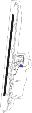
Medellín - Medellin Olaya Herrera
Airport details
| Country | Colombia |
| State | Antioquia |
| Region | SK |
| Airspace | Bogota Ctr |
| Municipality | Medellín |
| Elevation | 4937ft (1505m) |
| Timezone | GMT -5 |
| Coordinates | 6.22044, -75.59043 |
| Magnetic var | |
| Type | land |
| Available since | X-Plane v10.40 |
| ICAO code | SKMD |
| IATA code | EOH |
| FAA code | n/a |
Communication
| Medellin Olaya Herrera Ground Control | 121.900 |
| Medellin Olaya Herrera Tower | 118.900 |
| Medellin Olaya Herrera MEDELLIN Approach | 121.100 |
Nearby Points of Interest:
Enrique Olaya Herrera Airport
-Basilica of Our Lady of Candelaria
-Cerro El Volador
-Capilla de Nuestra Señora de la Candelaria
Nearby beacons
| code | identifier | dist | bearing | frequency |
|---|---|---|---|---|
| MRN | MARINILLA (RIONEGRO) VOR/DME | 16.1 | 99° | 113 |
| RNG | RIONEGRO (MEDELLIN) VOR/DME | 17.6 | 144° | 115.10 |
| PAL | PALANQUERO (PUERTO SALGAR VOR/DME | 70.8 | 128° | 114.20 |
| OTU | OTU VOR/DME | 71.2 | 48° | 115.40 |
Disclaimer
The information on this website is not for real aviation. Use this data with the X-Plane flight simulator only! Data taken with kind consent from X-Plane 12 source code and data files. Content is subject to change without notice.