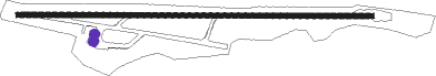
Manizales - La Nubia
Airport details
| Country | Colombia |
| State | Caldas |
| Region | SK |
| Airspace | Bogota Ctr |
| Municipality | Manizales |
| Elevation | 6871ft (2094m) |
| Timezone | GMT -5 |
| Coordinates | 5.03005, -75.46545 |
| Magnetic var | |
| Type | land |
| Available since | X-Plane v10.40 |
| ICAO code | SKMZ |
| IATA code | MZL |
| FAA code | n/a |
Communication
| La Nubia Tower | 118.200 |
| La Nubia MEDELLIN Approach | 121.100 |
Nearby Points of Interest:
Coffee Cultural Landscape of Colombia
Nearby beacons
| code | identifier | dist | bearing | frequency |
|---|---|---|---|---|
| MZL | MANIZALES VOR/DME | 4 | 291° | 112.10 |
| PEI | PEREIRA VOR/DME | 26.7 | 236° | 116 |
| MQU | MARIQUITA VOR/DME | 34.2 | 72° | 116.10 |
| AXM | ARMENIA VOR/DME | 38.6 | 208° | 111.60 |
| IBG | IBAGUE VOR/DME | 43.6 | 150° | 113.10 |
| ABL | AMBALEMA VOR/DME | 44.2 | 109° | 112.70 |
| PAL | PALANQUERO (PUERTO SALGAR VOR/DME | 55.4 | 60° | 114.20 |
| RNG | RIONEGRO (MEDELLIN) VOR/DME | 57.1 | 3° | 115.10 |
| GIR | GIRARDOT VOR/DME | 61.8 | 144° | 117.30 |
| TOL | GENERAL GUSTAVO ROJAS PIN VOR/DME | 67.8 | 133° | 111.20 |
| ULQ | TULUA VOR/DME | 72.4 | 219° | 117.70 |
Departure and arrival routes
| Transition altitude | 18000ft |
| Transition level | 19000ft |
| SID end points | distance | outbound heading | |
|---|---|---|---|
| RW28 | |||
| PEI1B | 27mi | 236° | |
| ISVO1C | 24mi | 338° | |
| STAR starting points | distance | inbound heading | |
|---|---|---|---|
| RW10 | |||
| PEI1C | 26.7 | 56° | |
| VULE1A | 16.0 | 108° | |
| NIRS1B | 19.1 | 192° | |
Disclaimer
The information on this website is not for real aviation. Use this data with the X-Plane flight simulator only! Data taken with kind consent from X-Plane 12 source code and data files. Content is subject to change without notice.