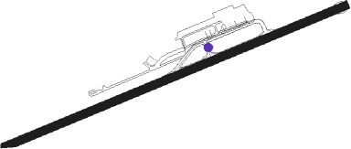
Pereira - Matecana
Airport details
| Country | Colombia |
| State | Risaralda |
| Region | SK |
| Airspace | Bogota Ctr |
| Municipality | Perimetro Urbano Pereira |
| Elevation | 4417ft (1346m) |
| Timezone | GMT -5 |
| Coordinates | 4.81276, -75.73932 |
| Magnetic var | |
| Type | land |
| Available since | X-Plane v10.40 |
| ICAO code | SKPE |
| IATA code | PEI |
| FAA code | n/a |
Communication
| Matecana Tower | 118.700 |
| Matecana Approach | 119.900 |
Approach frequencies
| ILS-cat-I | RW08 | 109.5 | 18.00mi |
| 3° GS | RW08 | 109.5 | 18.00mi |
Nearby Points of Interest:
Coffee Cultural Landscape of Colombia
Nearby beacons
| code | identifier | dist | bearing | frequency |
|---|---|---|---|---|
| PEI | PEREIRA VOR/DME | 6 | 252° | 116 |
| MZL | MANIZALES VOR/DME | 19.1 | 41° | 112.10 |
| AXM | ARMENIA VOR/DME | 21.2 | 184° | 111.60 |
| IBG | IBAGUE VOR/DME | 45.3 | 123° | 113.10 |
| ULQ | TULUA VOR/DME | 52.2 | 214° | 117.70 |
| MQU | MARIQUITA VOR/DME | 54.3 | 64° | 116.10 |
| ABL | AMBALEMA VOR/DME | 58.1 | 92° | 112.70 |
| GIR | GIRARDOT VOR/DME | 64.2 | 125° | 117.30 |
Departure and arrival routes
| Transition altitude | 18000ft |
| Transition level | 19000ft |
| SID end points | distance | outbound heading | |
|---|---|---|---|
| RW08 | |||
| NEBO1A | 20mi | 5° | |
| PEI4A | 19mi | 41° | |
| TOLI1C | 30mi | 151° | |
| TORO1F | 40mi | 215° | |
| RW26 | |||
| NEBO1B, MATR4B | 20mi | 5° | |
| TOLI1D | 30mi | 151° | |
| ISNO1A | 23mi | 152° | |
| AXM5B | 21mi | 184° | |
| TORO1H | 40mi | 215° | |
| IRIG2E, IRIG3B | 27mi | 218° | |
| AKSI2B | 20mi | 345° | |
| STAR starting points | distance | inbound heading | |
|---|---|---|---|
| ALL | |||
| AXM1K | 21.2 | 4° | |
| TORO1G | 40.1 | 35° | |
| AKSI1G | 20.3 | 165° | |
| MATR1G | 19.7 | 185° | |
| MZL1G | 19.1 | 221° | |
| ISNO1E, ISNO1D, ISNO1C | 23.1 | 332° | |
| RW08 | |||
| IRIG2D | 27.3 | 38° | |
| AKSI2A | 20.3 | 165° | |
| ISNO1B | 23.1 | 332° | |
Instrument approach procedures
| runway | airway (heading) | route (dist, bearing) |
|---|---|---|
| RW08-Y | DONBI (72°) | DONBI 8000ft SURVA (5mi, 72°) 7000ft |
| RNAV | SURVA 7000ft PULBO (4mi, 72°) 6000ft SKPE (6mi, 72°) 4392ft PE922 (turn) PE917 (4mi, 162°) 6600ft PE923 (2mi, 252°) PE901 (5mi, 242°) 8000ft PE903 (4mi, 252°) 8000ft PE806 (5mi, 252°) 9000ft DONBI (5mi, 342°) 9000ft DONBI (turn) 9000ft | |
| RW08-Z | DONBI (72°) | DONBI 8000ft SURVA (5mi, 72°) 7000ft |
| RNAV | SURVA 7000ft PULBO (4mi, 72°) 6000ft PE400 (3mi, 72°) 5051ft PE903 (9mi, 216°) 8000ft PE806 (5mi, 252°) 9000ft DONBI (5mi, 342°) 9000ft DONBI (turn) 9000ft | |
| RW26 | DONBI (72°) | DONBI 8000ft SURVA (5mi, 72°) 8000ft PE914 (2mi, 72°) 8000ft PE915 (5mi, 99°) 8000ft |
| RW26 | ISNOX (332°) | ISNOX PE911 (3mi, 280°) 15000ft PE912 (8mi, 307°) 12500ft PE913 (8mi, 307°) 10500ft PE915 (8mi, 23°) 8000ft |
| RNAV | PE915 8000ft PE916 (2mi, 99°) PE917 (2mi, 99°) 7500ft PE918 (4mi, 356°) 4950ft PE260 (2mi, 252°) 4468ft PE919 (4mi, 252°) 5450ft PE920 (8mi, 304°) 6900ft PE921 (6mi, 252°) 8000ft DONBI (6mi, 162°) 9000ft DONBI (turn) 9000ft |
Disclaimer
The information on this website is not for real aviation. Use this data with the X-Plane flight simulator only! Data taken with kind consent from X-Plane 12 source code and data files. Content is subject to change without notice.
