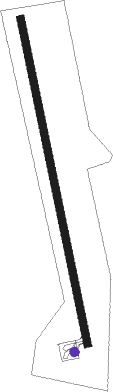
San Gil - Los Pozos
Airport details
| Country | Colombia |
| State | Santander |
| Region | SK |
| Airspace | Bogota Ctr |
| Municipality | San Gil |
| Elevation | 5563ft (1696m) |
| Timezone | GMT -5 |
| Coordinates | 6.59000, -73.12900 |
| Magnetic var | |
| Type | land |
| Available since | X-Plane v10.40 |
| ICAO code | SKSG |
| IATA code | n/a |
| FAA code | n/a |
Communication
Nearby beacons
| code | identifier | dist | bearing | frequency |
|---|---|---|---|---|
| PIE | PIEDECUESTA VOR/DME | 17.7 | 7° | 116.80 |
| EJA | BARRANCABERMEJA VOR/DME | 48.1 | 303° | 115.90 |
Disclaimer
The information on this website is not for real aviation. Use this data with the X-Plane flight simulator only! Data taken with kind consent from X-Plane 12 source code and data files. Content is subject to change without notice.