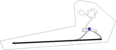
La Paz / El Alto - El Alto
Airport details
| Country | Bolivia |
| State | La Paz |
| Region | SL |
| Airspace | La Paz Ctr |
| Municipality | El Alto |
| Elevation | 13312ft (4057m) |
| Timezone | GMT -4 |
| Coordinates | -16.51250, -68.19222 |
| Magnetic var | |
| Type | land |
| Available since | X-Plane v10.40 |
| ICAO code | SLLP |
| IATA code | LPB |
| FAA code | n/a |
Communication
| El Alto Ground | 121.900 |
| El Alto Tower | 118.300 |
| El Alto Approach | 119.500 |
| El Alto Departure | 119.500 |
Approach frequencies
| ILS-cat-I | RW10 | 110.3 | 18.00mi |
| 2.4° GS | RW10 | 110.3 | 18.00mi |
Nearby Points of Interest:
Edificio Galería República
-Edificio Ferretería Kautsch
-Palacio Consistorial de La Paz
-Palacio Quemado
-Las Flaviadas
Nearby beacons
| code | identifier | dist | bearing | frequency |
|---|---|---|---|---|
| LPZ | LA PAZ NDB | 1.3 | 78° | 350 |
| PAZ | LA PAZ VOR/DME | 2.3 | 271° | 115.70 |
| CRC | COROICO NDB | 33.1 | 56° | 305 |
Departure and arrival routes
| Transition altitude | 18000ft |
| SID end points | distance | outbound heading | |
|---|---|---|---|
| RW10 | |||
| ELAMU1, ELAMU2 | 55mi | 0° | |
| TERAX1 | 53mi | 103° | |
| DAKOG1 | 53mi | 115° | |
| UREMA1 | 53mi | 132° | |
| ARPIS7 | 54mi | 147° | |
| LONAB1 | 54mi | 161° | |
| IROBO1 | 56mi | 189° | |
| TEGUM1 | 57mi | 230° | |
| KOVIS1 | 57mi | 242° | |
| KOMPA6, KOMPA7 | 47mi | 273° | |
| ELAKO7, ELAKO6 | 73mi | 298° | |
| KIBUX1 | 56mi | 335° | |
| RW28 | |||
| ELAMU2, ELAMU1 | 55mi | 0° | |
| RENEP1 | 54mi | 35° | |
| REDIR1 | 53mi | 48° | |
| SALKO1 | 53mi | 59° | |
| KIGAX1 | 53mi | 61° | |
| TERAX1 | 53mi | 103° | |
| DAKOG1 | 53mi | 115° | |
| UREMA1 | 53mi | 132° | |
| ARPIS7 | 54mi | 147° | |
| LONAB1 | 54mi | 161° | |
| IROBO1 | 56mi | 189° | |
| TEGUM1 | 57mi | 230° | |
| KOVIS1 | 57mi | 242° | |
| KOMPA6, KOMPA7 | 47mi | 273° | |
| ELAKO7, ELAKO6 | 73mi | 298° | |
| KIBUX1 | 56mi | 335° | |
Instrument approach procedures
| runway | airway (heading) | route (dist, bearing) |
|---|---|---|
| RW10-Y | LP623 (92°) | LP623 18000ft LP624 (6mi, 92°) 15800ft |
| RW10-Y | LP653 (57°) | LP653 18000ft LP624 (8mi, 2°) 15800ft |
| RW10-Y | LP655 (127°) | LP655 18000ft LP624 (8mi, 182°) 15800ft |
| RNAV | LP624 15800ft LP657 (5mi, 92°) 14500ft SLLP (6mi, 91°) 13161ft LP627 (20mi, 180°) 17000ft LP627 (turn) 17000ft |
Disclaimer
The information on this website is not for real aviation. Use this data with the X-Plane flight simulator only! Data taken with kind consent from X-Plane 12 source code and data files. Content is subject to change without notice.
