Orellana
Airport details
| Country | Peru |
| State | Loreto |
| Region | SP |
| Airspace | Lima Ctr |
| Municipality | Vargas Guerra |
| Elevation | 354ft (108m) |
| Timezone | GMT -5 |
| Coordinates | -6.89667, -75.15305 |
| Magnetic var | |
| Type | land |
| Available since | X-Plane v10.40 |
| ICAO code | SPON |
| IATA code | n/a |
| FAA code | n/a |
Communication
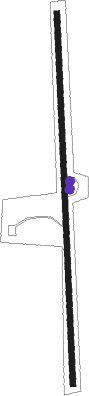
Runway info
| Runway 18 / 36 | ||
| length | 998m (3274ft) | |
| bearing | 182° / 2° | |
| width | 14m (47ft) | |
| surface | dirt | |
Disclaimer
The information on this website is not for real aviation. Use this data with the X-Plane flight simulator only! Data taken with kind consent from X-Plane 12 source code and data files. Content is subject to change without notice.