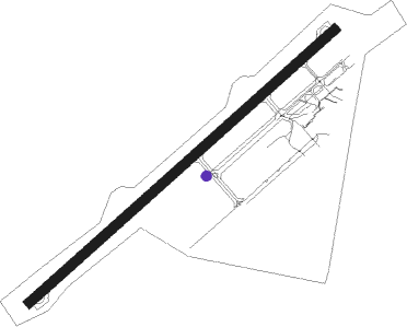
Ogle - Correira Intl
Airport details
| Country | Guyana |
| State | Demerara-Mahaica |
| Region | SY |
| Airspace | Georgetown Ctr |
| Municipality | Industry - Plaisance |
| Elevation | 8ft (2m) |
| Timezone | GMT -4 |
| Coordinates | 6.80534, -58.10599 |
| Magnetic var | |
| Type | land |
| Available since | X-Plane v10.40 |
| ICAO code | SYEC |
| IATA code | OGL |
| FAA code | n/a |
Communication
| Correira Intl Ogle Ground | 121.900 |
| Correira Intl Ogle Tower | 118.550 |
| Correira Intl Timehri APCH | 119.400 |
| Correira Intl Timehri APCH | 118.300 |
Nearby beacons
| code | identifier | dist | bearing | frequency |
|---|---|---|---|---|
| TIM | TIMEHRI (GEORGETOWN) VOR/DME | 20.7 | 206° | 113.50 |
Instrument approach procedures
| runway | airway (heading) | route (dist, bearing) |
|---|---|---|
| RW07 | EC120 (80°) | EC120 2000ft EC110 (5mi, 143°) 2000ft |
| RW07 | EC130 (27°) | EC130 2000ft EC110 (5mi, 323°) 2000ft |
| RNAV | EC110 2000ft EC100 (5mi, 53°) 1500ft SYEC (5mi, 54°) 52ft EC200 (2mi, 51°) EC210 (6mi, 335°) EC220 (6mi, 269°) EC120 (10mi, 207°) 2000ft | |
| RW25 | EC320 (205°) | EC320 2000ft EC310 (5mi, 143°) 2000ft |
| RW25 | EC330 (259°) | EC330 2000ft EC310 (5mi, 323°) 2000ft |
| RNAV | EC310 2000ft EC300 (5mi, 233°) 1500ft SYEC (5mi, 232°) 52ft EC400 (7mi, 234°) EC410 (8mi, 323°) EC420 (6mi, 53°) EC320 (11mi, 70°) 2000ft |
Disclaimer
The information on this website is not for real aviation. Use this data with the X-Plane flight simulator only! Data taken with kind consent from X-Plane 12 source code and data files. Content is subject to change without notice.
