Eagle Mountain - Hicks
Airport details
| Country | United States of America |
| State | Texas |
| Region | K4 |
| Airspace | Ft Worth Ctr |
| Municipality | Tarrant County |
| Elevation | 854ft (260m) |
| Timezone | GMT -6 |
| Coordinates | 32.93124, -97.41169 |
| Magnetic var | |
| Type | land |
| Available since | X-Plane v10.40 |
| ICAO code | T67 |
| IATA code | n/a |
| FAA code | n/a |
Communication
| Hicks CTAF/UNICOM | 123.050 |
Nearby Points of Interest:
Henderson Street Bridge
-Paddock Viaduct
-Heritage Park Plaza
-Tarrant County Courthouse
-William J. Bryce House
-Cotton Belt Railroad Industrial Historic District
-Butler Place Historic District
-Eighth Avenue Historic District
-Stephen F. Austin Elementary School
-Thomas Shiels House
-Elizabeth Boulevard Historic District
-Grand Avenue Historic District
-Ridglea Theatre
-Leuda-May Historic District
-Burk Burnett Building
-Central Handley Historic District
-Fort Worth
-Knights of Pythias Building
-Will Rogers Memorial Center
-Westover Manor
-First National Bank Building
-F. W. Woolworth Building
-Fort Worth Elks Lodge 124
-Kress Building
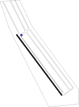
Runway info
| Runway 14 / 32 | ||
| length | 1141m (3743ft) | |
| bearing | 143° / 323° | |
| width | 18m (60ft) | |
| surface | asphalt | |
| displ threshold | 104m (341ft) / 58m (190ft) | |
Nearby beacons
| code | identifier | dist | bearing | frequency |
|---|---|---|---|---|
| FT | MUFIN (FORT WORTH) NDB | 2.9 | 135° | 365 |
| NFW | NAS JRB FORT WORTH (FT WO TACAN | 9.7 | 190° | 108.70 |
| FUZ | RANGER (DALLAS-FORT WORTH VORTAC | 11.9 | 100° | 115.70 |
| TTT | MAVERICK VOR/DME | 19 | 99° | 113.10 |
| DT | PINCK (DENTON) NDB | 23.7 | 31° | 257 |
| CVE | COWBOY (DALLAS) VOR/DME | 25.7 | 95° | 116.20 |
| MQP | MILLSAP (MINERAL WELLS) VORTAC | 32 | 251° | 117.70 |
| UKW | BOWIE VORTAC | 41.7 | 326° | 117.15 |
| PQF | MESQUITE NDB | 45.1 | 98° | 248 |
| JEN | GLEN ROSE TACAN | 52 | 211° | 115 |
| DNI | DENISON (SHERMAN-DENISON) NDB | 65.4 | 40° | 341 |
| CGQ | POWELL (CORSICANA) NDB | 72.1 | 131° | 344 |
Disclaimer
The information on this website is not for real aviation. Use this data with the X-Plane flight simulator only! Data taken with kind consent from X-Plane 12 source code and data files. Content is subject to change without notice.