Vieques Island - Antonio Rivera Rodriquez
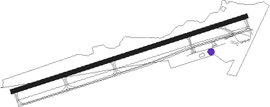
Airport details
| Country | United States of America |
| State | Puerto Rico |
| Region | TJ |
| Airspace | San Juan Oceanic Ctr |
| Municipality | Vieques |
| Elevation | 46ft (14m) |
| Timezone | GMT -4 |
| Coordinates | 18.13481, -65.49361 |
| Magnetic var | |
| Type | land |
| Available since | X-Plane v10.40 |
| ICAO code | TJVQ |
| IATA code | VQS |
| FAA code | n/a |
Communication
| Antonio Rivera Rodriquez CTAF | 123.000 |
| Antonio Rivera Rodriquez SAN JUAN CERAP | 128.650 |
Nearby Points of Interest:
United States Customs House
-Santiago Apóstol Cathedral
-Casa Roig Museum
-Estate Brewers Bay
-Hamburg-America Shipping Line Administrative Offices
-Charlotte Amalie Historic District
-Legislature Building
-Casa Klumb
-New Herrnhut Moravian Church
-Río Piedras State Penitentiary
-Eleuterio Derkes Grammar School
-Vives Sugar Mill
-Dr. Concha Meléndez Ramírez House
-La Fortaleza
Nearby beacons
| code | identifier | dist | bearing | frequency |
|---|---|---|---|---|
| STT | SAINT THOMAS VOR/DME | 29.8 | 65° | 108.60 |
| SJU | SAN JUAN VORTAC | 33.9 | 302° | 114 |
| SJ | PATTY (SAN JUAN) NDB | 37.7 | 295° | 330 |
| ST | PESTE (CHRISTIANSTED) NDB | 43.8 | 126° | 241 |
| COY | SAINT CROIX VOR/DME | 51.2 | 117° | 108.20 |
| DDP | DORADO (SAN JUAN) NDB | 56 | 290° | 391 |
Departure and arrival routes
| Transition altitude | 18000ft |
| Transition level | 18000ft |
| SID end points | distance | outbound heading | |
|---|---|---|---|
| RW09 | |||
| VEDAS5 | 14mi | 203° | |
| RW27 | |||
| VEDAS5 | 14mi | 203° | |
Instrument approach procedures
| runway | airway (heading) | route (dist, bearing) |
|---|---|---|
| RW09 | TUUNA (69°) | TUUNA MIXEE (13mi, 61°) 3000ft |
| RW09 | VEDAS (23°) | VEDAS MIXEE (12mi, 330°) 3000ft MIXEE (turn) 3000ft |
| RNAV | MIXEE 3000ft PEVOE (5mi, 77°) 2000ft CAVTU (3mi, 77°) 1140ft MUNGE (3mi, 77°) 251ft (4012mi, 105°) 449ft MIXEE (4021mi, 285°) 3000ft MIXEE (turn) |
Disclaimer
The information on this website is not for real aviation. Use this data with the X-Plane flight simulator only! Data taken with kind consent from X-Plane 12 source code and data files. Content is subject to change without notice.