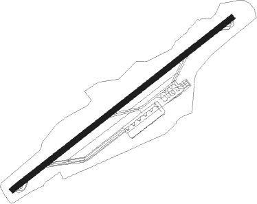
Basseterre - St. Kitts/bradshaw Intl
Airport details
| Country | Saint Kitts and Nevis |
| State | Saint Kitts |
| Region | TK |
| Airspace | Piarco Ctr |
| Municipality | Saint Peter Basseterre |
| Elevation | 166ft (51m) |
| Timezone | GMT -4 |
| Coordinates | 17.31118, -62.71869 |
| Magnetic var | |
| Type | land |
| Available since | X-Plane v10.40 |
| ICAO code | TKPK |
| IATA code | SKB |
| FAA code | n/a |
Communication
| St. Kitts/Bradshaw Intl AWOS | 118.100 |
| St. Kitts/Bradshaw Intl Ground Control | 121.900 |
| St. Kitts/Bradshaw Intl Tower | 118.300 |
| St. Kitts/Bradshaw Intl Approach | 119.600 |
Nearby Points of Interest:
Charlestown
Nearby beacons
| code | identifier | dist | bearing | frequency |
|---|---|---|---|---|
| SKB | L BRADSHAW (ST KIT DME | 0.5 | 243° | 112 |
| SKB | ROBERT L BRADSHAW (ST KITTS) NDB | 1.7 | 238° | 325 |
| PJM | SAINT MAARTEN VOR/DME | 49.2 | 331° | 113 |
| ZDX | V C BIRD (SAINT JOHNS) NDB | 53.7 | 99° | 369 |
| ANU | V C BIRD (SAINT JOHNS) VOR/DME | 53.8 | 101° | 114.50 |
Departure and arrival routes
| Transition altitude | 5000ft |
| SID end points | distance | outbound heading | |
|---|---|---|---|
| RW07 | |||
| UDGEL1 | 16mi | 279° | |
| KIPUR1 | 12mi | 325° | |
| RW25 | |||
| DUSUL1 | 12mi | 325° | |
Instrument approach procedures
| runway | airway (heading) | route (dist, bearing) |
|---|---|---|
| RW07 | ANASU (314°) | ANASU 5000ft EPVOS (20mi, 287°) 5000ft IKNIG (10mi, 286°) 4000ft LOMDO (6mi, 326°) 3200ft DUSUL (5mi, 58°) 2000ft |
| RW07 | BOMET (282°) | BOMET 5000ft TABOX (26mi, 261°) 5000ft IKNIG (10mi, 261°) 4000ft LOMDO (6mi, 326°) 3200ft DUSUL (5mi, 58°) 2000ft |
| RW07 | GABAR (99°) | GABAR 3200ft OMONO (5mi, 155°) 3200ft LOMDO (6mi, 146°) 3200ft DUSUL (5mi, 58°) 2000ft |
| RW07 | ITRUS (288°) | ITRUS 5000ft PURID (16mi, 258°) 5000ft IKNIG (10mi, 258°) 4000ft LOMDO (6mi, 326°) 3200ft DUSUL (5mi, 58°) 2000ft |
| RW07 | LOMDO (58°) | LOMDO 3200ft DUSUL (5mi, 58°) 2000ft |
| RW07 | ZPATA (145°) | ZPATA 5000ft IMOTA (10mi, 214°) 5000ft OMONO (4mi, 214°) 4000ft LOMDO (6mi, 146°) 3200ft DUSUL (5mi, 58°) 2000ft |
| RNAV | DUSUL 2000ft EMETA (2mi, 58°) 2000ft TKPK (5mi, 58°) 218ft UDGEL (13mi, 58°) 3000ft UDGEL (turn) 10000ft | |
| RW25 | ANASU (314°) | ANASU 3000ft EMLEX (10mi, 341°) 3000ft DUVON (6mi, 341°) 3000ft MAXVU (8mi, 343°) 3000ft UDGEL (6mi, 326°) 2500ft |
| RW25 | BOMET (282°) | BOMET 3000ft MAXVU (17mi, 299°) 3000ft UDGEL (6mi, 326°) 2500ft |
| RW25 | GABAR (99°) | GABAR 5000ft KASAM (20mi, 69°) 5000ft NOVAR (5mi, 69°) 4000ft UDGEL (6mi, 146°) 2500ft |
| RW25 | UDGEL (238°) | UDGEL 2500ft |
| RW25 | ZPATA (145°) | ZPATA 4000ft NOVAR (14mi, 81°) 4000ft UDGEL (6mi, 146°) 2500ft |
| RNAV | UDGEL 2500ft KIPUR (6mi, 238°) 2000ft RADAT (3mi, 238°) 1000ft IKNIG (17mi, 217°) 1400ft LOMDO (6mi, 326°) 3200ft LOMDO (turn) 10000ft |
Disclaimer
The information on this website is not for real aviation. Use this data with the X-Plane flight simulator only! Data taken with kind consent from X-Plane 12 source code and data files. Content is subject to change without notice.
