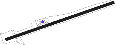
Castries - George F L Charles
Airport details
| Country | Saint Lucia |
| State | Castries |
| Region | TL |
| Airspace | Piarco Ctr |
| Elevation | 20ft (6m) |
| Timezone | GMT -4 |
| Coordinates | 14.02000, -60.99306 |
| Magnetic var | |
| Type | land |
| Available since | X-Plane v10.40 |
| ICAO code | TLPC |
| IATA code | SLU |
| FAA code | TLPC |
Communication
| George F L Charles ATIS | 132.600 |
| George F L Charles Ground Control | 121.900 |
| George F L Charles GEORGE CHARLES Tower | 118.000 |
| George F L Charles ST LUCIA APCH | 119.800 |
| George F L Charles ST LUCIA Departure | 119.800 |
Nearby beacons
| code | identifier | dist | bearing | frequency |
|---|---|---|---|---|
| SLU | GEORGE CHARLES (ST. LUCIA) NDB | 0.8 | 246° | 415 |
| BNE | HEWANORRA (SAINT LUCIA) NDB | 17.2 | 177° | 305 |
| FOF | MARTINIQUE VOR/DME | 34.3 | 357° | 113.30 |
| SV | ST VINCENT (SAINT VINCENT I) NDB | 54.5 | 195° | 403 |
Instrument approach procedures
| runway | airway (heading) | route (dist, bearing) |
|---|---|---|
| RW09 | BNE (357°) | BNE 4000ft ILOGO (15mi, 293°) 4000ft DERMI (8mi, 360°) 2000ft |
| RW09 | DERMI (75°) | DERMI 2000ft |
| RW09 | FOF (177°) | FOF NUKAK (28mi, 199°) 3000ft OMTIN (7mi, 210°) 2000ft DERMI (5mi, 165°) 2000ft |
| RW09 | KISES (177°) | KISES 6100ft OMTIN (16mi, 239°) 2000ft DERMI (5mi, 165°) 2000ft |
| RW09 | RIBOR (12°) | RIBOR 6NM (10mi, 341°) 4000ft LIDOG (6mi, 341°) 3000ft TUBED (6mi, 360°) 2000ft ILOGO (6mi, 360°) 2000ft DERMI (8mi, 360°) 2000ft |
| RW09 | UMENU (19°) | UMENU LIDOG (13mi, 358°) 3000ft TUBED (6mi, 360°) 2000ft ILOGO (6mi, 360°) 2000ft DERMI (8mi, 360°) 2000ft |
| RNAV | DERMI 2000ft SAVEL (7mi, 75°) 1800ft PUREX (4mi, 75°) 548ft DERMI (11mi, 255°) 2000ft DERMI (turn) |
Disclaimer
The information on this website is not for real aviation. Use this data with the X-Plane flight simulator only! Data taken with kind consent from X-Plane 12 source code and data files. Content is subject to change without notice.
