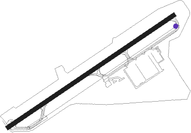
Road Town - Terrance B Lettsome Intl
Airport details
| Country | British Virgin Islands |
| State | [Other] |
| Region | TU |
| Airspace | San Juan Oceanic Ctr |
| Municipality | Other British Virgin Islands |
| Elevation | 15ft (5m) |
| Timezone | GMT -4 |
| Coordinates | 18.44555, -64.54166 |
| Magnetic var | |
| Type | land |
| Available since | X-Plane v10.40 |
| ICAO code | TUPJ |
| IATA code | EIS |
| FAA code | n/a |
Communication
| Terrance B Lettsome Intl BEEF ISLAND ATIS | 127.750 |
| Terrance B Lettsome Intl BEEF ISLAND CTAF | 118.400 |
| Terrance B Lettsome Intl BEEF ISLAND Ground Control | 121.900 |
| Terrance B Lettsome Intl BEEF ISLAND Tower | 118.400 |
| Terrance B Lettsome Intl San Juan Center | 128.650 |
| Terrance B Lettsome Intl San Juan Center | 132.250 |
Nearby Points of Interest:
Estate Carolina Sugar Plantation
-Annaberg Historic District
-Mary Point Estate
-Reef Bay Trail petroglyphs
-Cinnamon Bay Plantation
-Reef Bay Sugar Factory Historic District
-Cruz Bay
-Lind Point Fort
-New Herrnhut Moravian Church
-Legislature Building
-Charlotte Amalie Historic District
-Hamburg-America Shipping Line Administrative Offices
-Estate Brewers Bay
Nearby beacons
| code | identifier | dist | bearing | frequency |
|---|---|---|---|---|
| STT | SAINT THOMAS VOR/DME | 28 | 259° | 108.60 |
| COY | SAINT CROIX VOR/DME | 43.6 | 193° | 108.20 |
| ST | PESTE (CHRISTIANSTED) NDB | 49.3 | 204° | 241 |
Instrument approach procedures
| runway | airway (heading) | route (dist, bearing) |
|---|---|---|
| RW25 | LIRDO (217°) | LIRDO 3000ft SILDI (5mi, 149°) 2500ft |
| RW25 | SIMBO (266°) | SIMBO 3000ft SILDI (5mi, 330°) 2500ft |
| RNAV | SILDI 2500ft LEVOM (5mi, 242°) 2000ft TUPJ (6mi, 242°) 58ft SIMBO (12mi, 86°) 3000ft SILDI (5mi, 330°) SILDI (turn) 3000ft | |
| RWNVA | BILPO (10°) | BILPO 3000ft SELOD (5mi, 298°) 2500ft |
| RWNVA | DRINK (97°) | DRINK LONKO (21mi, 126°) 3300ft SELOD (5mi, 118°) 2500ft |
| RWNVA | VIPVI (360°) | VIPVI 3000ft BILPO (5mi, 210°) 3000ft SELOD (5mi, 298°) 2500ft |
| RNAV | SELOD 2500ft EMULA (5mi, 30°) 2500ft ILALO (6mi, 30°) 1220ft VIPVI (8mi, 167°) 3000ft VIPVI (turn) 3000ft |
Disclaimer
The information on this website is not for real aviation. Use this data with the X-Plane flight simulator only! Data taken with kind consent from X-Plane 12 source code and data files. Content is subject to change without notice.