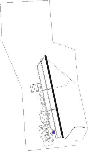
Oquirrh - South Valley Rgnl
Airport details
| Country | United States of America |
| State | Utah |
| Region | K2 |
| Airspace | Salt Lake City Ctr |
| Municipality | West Jordan |
| Elevation | 4604ft (1403m) |
| Timezone | GMT -7 |
| Coordinates | 40.61622, -111.99460 |
| Magnetic var | |
| Type | land |
| Available since | X-Plane v10.40 |
| ICAO code | U42 |
| IATA code | n/a |
| FAA code | n/a |
Communication
| South Valley Rgnl AWOS 3 | 134.425 |
| South Valley Rgnl CTAF/UNICOM | 122.700 |
| South Valley Rgnl Salt Lake City Approach | 120.900 |
| South Valley Rgnl Salt Lake City Departure | 120.900 |
Nearby Points of Interest:
West Jordan Ward Meetinghouse
-Gardner Mill
-Murray LDS Second Ward Meetinghouse
-Hyrum and Selma Erickson Jacobson House
-John and Mary Mattson House
-Sandy City Bank
-Sandy Historic District
-Sandy Tithing Office
-Sandy Second Ward Chapel
-John P. Cahoon House
-Murray Downtown Residential Historic District
-Murray Downtown Historic District
-Brady-Brady House
-Riverton Elementary School
-Draper-Steadman House
-Amanda Conk Best House
-Harold W. and Evelyn Burton House
-Draper Park School
-Draper Poultrymen and Egg Producers' Plant
-Joseph E. and Mina W. Mickelsen House
-S.J. Mickelsen Hardware Store and Lumber Yard
-Nielsen-Sanderson House
-Benjamin and Olivia Meek House
-Perry and Agnes Wadsworth Fitzgerald House
-Fitzgerald House
Nearby beacons
| code | identifier | dist | bearing | frequency |
|---|---|---|---|---|
| TCH | WASATCH VORTAC | 14 | 3° | 116.80 |
| FFU | FAIRFIELD (PROVO) VORTAC | 20.6 | 171° | 116.60 |
| PVU | PROVO VOR/DME | 27.1 | 146° | 108.40 |
| HIF | HILL (OGDEN) TACAN | 30.3 | 4° | 111.20 |
| OGD | OGDEN VORTAC | 36.8 | 350° | 115.70 |
| MIJ | MICHAEL (DUGWAY) TACAN | 49.4 | 245° | 113.20 |
| EVW | EVANSTON VOR/DME | 58.3 | 55° | 109.60 |
Departure and arrival routes
| Transition altitude | 18000ft |
| Transition level | 18000ft |
| SID end points | distance | outbound heading | |
|---|---|---|---|
| RW16 | |||
| SVALY1 | 21mi | 171° | |
| RW34 | |||
| SVALY1 | 21mi | 171° | |
Instrument approach procedures
| runway | airway (heading) | route (dist, bearing) |
|---|---|---|
| RW34 | FFU (351°) | FFU 9000ft |
| RNAV | FFU 9000ft KOCEN (4mi, 352°) 9000ft LODME (7mi, 352°) 7600ft ACIPO (5mi, 350°) 6080ft HOKIT (2mi, 350°) 5380ft U42 (3mi, 347°) 4660ft (6397mi, 110°) 4881ft DUYDE (6397mi, 290°) KITBE (7mi, 315°) STACO (15mi, 279°) 9000ft STACO (turn) |
Disclaimer
The information on this website is not for real aviation. Use this data with the X-Plane flight simulator only! Data taken with kind consent from X-Plane 12 source code and data files. Content is subject to change without notice.
