Beaver - Beaver Muni
Airport details
| Country | United States of America |
| State | Utah |
| Region | K2 |
| Airspace | Salt Lake City Ctr |
| Municipality | Beaver County |
| Elevation | 5857ft (1785m) |
| Timezone | GMT -7 |
| Coordinates | 38.23058, -112.67542 |
| Magnetic var | |
| Type | land |
| Available since | X-Plane v10.40 |
| ICAO code | U52 |
| IATA code | n/a |
| FAA code | U52 |
Communication
| Beaver Muni AWOS 3 | 119.925 |
| Beaver Muni CTAF | 122.900 |
Nearby Points of Interest:
Elliot Willden House
-Charles A. Dalten House
-Beaver City Library
-Samuel Jackson House
-Julia P.M. Farnsworth Barn
-Julia Farnsworth House
-United States Post Office–Beaver Main
-Odd Fellows Hall
-Beaver Relief Society Meetinghouse
-Beaver Opera House
-Erickson House
-Edward Bird House
-Beaver County Courthouse
-Meeting Hall
-Edward Fernley House
-William Burt House
-Charles Dennis White House
-Sarah Eliza Harris House
-Fort Cameron
-Rollins-Eyre House
-Piute County Courthouse
-John and Ella Morrill House
-Meeks-Green Farmstead
-Parowan Meetinghouse
-Jesse N. Smith House
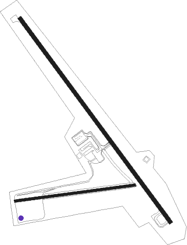
Runway info
Runway 13 / 31  | ||
| length | 1518m (4980ft) | |
| bearing | 141° / 321° | |
| width | 23m (75ft) | |
| surface | asphalt | |
| blast zone | 39m (128ft) / 0m (0ft) | |
| Runway 07 / 25 | ||
| length | 725m (2379ft) | |
| bearing | 88° / 268° | |
| width | 15m (50ft) | |
| surface | dirt | |
| displ threshold | 0m (0ft) / 67m (220ft) | |
Nearby beacons
| code | identifier | dist | bearing | frequency |
|---|---|---|---|---|
| MLF | MILFORD VORTAC | 17.7 | 291° | 112.10 |
| EHK | ENOCH VOR/DME | 32.4 | 222° | 117.30 |
| BCE | BRYCE CANYON VORTAC | 36.9 | 146° | 112.80 |
Instrument approach procedures
| runway | airway (heading) | route (dist, bearing) |
|---|---|---|
| RWNVA | BCE (326°) | BCE VOGUY (43mi, 308°) 12400ft VOGUY (turn) 9600ft |
| RWNVA | BERYL (65°) | BERYL VOGUY (27mi, 56°) 9600ft |
| RWNVA | CUSAK (59°) | CUSAK VOGUY (12mi, 26°) 9600ft |
| RWNVA | DETAN (198°) | DETAN VOGUY (19mi, 241°) 11300ft VOGUY (turn) 9600ft |
| RWNVA | MLF (111°) | MLF VOGUY (10mi, 160°) 9600ft |
| RNAV | VOGUY 9600ft ICIRA (6mi, 83°) 9000ft CUVSI (7mi, 83°) 7580ft (6464mi, 109°) 7580ft VOGUY (6477mi, 289°) 9600ft VOGUY (turn) |
Disclaimer
The information on this website is not for real aviation. Use this data with the X-Plane flight simulator only! Data taken with kind consent from X-Plane 12 source code and data files. Content is subject to change without notice.