Nakhchivan
Airport details
| Country | Azerbaijan |
| State | Naxcivan |
| Region | UB |
| Airspace | Yerevan Ctr |
| Municipality | Babek District |
| Elevation | 2861ft (872m) |
| Timezone | GMT +4 |
| Coordinates | 39.18912, 45.45288 |
| Magnetic var | |
| Type | land |
| Available since | X-Plane v10.40 |
| ICAO code | UBBN |
| IATA code | NAJ |
| FAA code | n/a |
Communication
| Nakhchivan ATIS | 127.500 |
| Nakhchivan Tower | 118.200 |
| Nakhchivan Approach | 118.200 |
Approach frequencies
| ILS-cat-I | RW32L | 111.1 | 18.00mi |
| ILS-cat-I | RW32R | 109.1 | 18.00mi |
| ILS-cat-I | RW14R | 111.7 | 18.00mi |
| ILS-cat-I | RW14L | 109.5 | 18.00mi |
| 3° GS | RW32L | 111.1 | 18.00mi |
| 3° GS | RW32R | 109.1 | 18.00mi |
| 3° GS | RW14R | 111.7 | 18.00mi |
| 3° GS | RW14L | 109.5 | 18.00mi |
Nearby Points of Interest:
Momine Khatun Mausoleum
-Church of the Holy Mother of God (Darresham)
-Armenian Monastic Ensembles of Iran
-Churs Icehouse
-Mozrov Cave
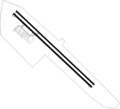
Runway info
Runway 14L / 32R  | ||
| length | 3303m (10837ft) | |
| bearing | 131° / 311° | |
| width | 42m (138ft) | |
| surface | asphalt | |
| displ threshold | 0m (0ft) / 305m (1001ft) | |
| blast zone | 30m (98ft) / 0m (0ft) | |
| Runway 14R / 32L | ||
| length | 3299m (10823ft) | |
| bearing | 130° / 310° | |
| width | 45m (148ft) | |
| surface | concrete | |
| displ threshold | 0m (0ft) / 114m (374ft) | |
| blast zone | 70m (230ft) / 59m (194ft) | |
Nearby beacons
| code | identifier | dist | bearing | frequency |
|---|---|---|---|---|
| NAX | NAKHCHIVAN VOR/DME | 0.9 | 316° | 116.50 |
| NO | NAKHCHIVAN NDB | 2.1 | 126° | 493 |
| MAK | MAKU VOR/DME | 23.7 | 270° | 112.40 |
| AND | ANDRANIK NDB | 44 | 324° | |
| KHY | KHOY VOR/DME | 50.7 | 213° | 114.90 |
| KHY | KHOY NDB | 50.9 | 212° | 288 |
| ER | EREBUNI (YEREVAN) NDB | 72.9 | 315° | 496 |
Departure and arrival routes
| Transition altitude | 12000ft |
| Transition level | 13000ft |
| SID end points | distance | outbound heading | |
|---|---|---|---|
| RW14 (ALL) | |||
| DULA3A, DULA3C | 17mi | 143° | |
| TUXA1C, TUXA1A | 45mi | 306° | |
| NEGA3A, NEGA3C | 40mi | 322° | |
| IRLA3C, IRLA3A | 19mi | 358° | |
| RW32 (ALL) | |||
| DULA2B, DULA2D | 17mi | 143° | |
| TUXA1B, TUXA1D | 45mi | 306° | |
| NEGA2B, NEGA2D | 40mi | 322° | |
| IRLA2D, IRLA2B | 19mi | 358° | |
| STAR starting points | distance | inbound heading | |
|---|---|---|---|
| RW14L | |||
| TUXA1E | 45.3 | 126° | |
| NEGA2E | 39.7 | 142° | |
| IRLA2E | 19.3 | 178° | |
| DULA2E, DULA3E | 16.6 | 323° | |
| RW14R | |||
| TUXA1G | 45.3 | 126° | |
| NEGA2G | 39.7 | 142° | |
| IRLA2G | 19.3 | 178° | |
| DULA3G, DULA2G | 16.6 | 323° | |
| RW32L | |||
| TUXA1H | 45.3 | 126° | |
| NEGA2H | 39.7 | 142° | |
| IRLA2H | 19.3 | 178° | |
| DULA2H | 16.6 | 323° | |
| RW32R | |||
| TUXA1F | 45.3 | 126° | |
| NEGA2F | 39.7 | 142° | |
| IRLA2F | 19.3 | 178° | |
| DULA2F | 16.6 | 323° | |
Disclaimer
The information on this website is not for real aviation. Use this data with the X-Plane flight simulator only! Data taken with kind consent from X-Plane 12 source code and data files. Content is subject to change without notice.