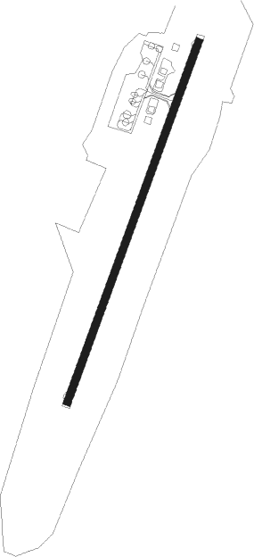
Nogliki
Airport details
| Country | Russian Federation |
| State | Sakhalin Oblast |
| Region | UH |
| Airspace | Khabarovsk Ctr |
| Municipality | Nogliki |
| Elevation | 126ft (38m) |
| Timezone | GMT +11 |
| Coordinates | 51.78389, 143.14194 |
| Magnetic var | |
| Type | land |
| Available since | X-Plane v10.40 |
| ICAO code | UHSN |
| IATA code | NGK |
| FAA code | n/a |
Communication
| Nogliki Tower | 132.000 |
Approach frequencies
| ILS-cat-I | RW22 | 108.1 | 18.00mi |
| 2.7° GS | RW22 | 108.1 | 18.00mi |
Nearby beacons
| code | identifier | dist | bearing | frequency |
|---|---|---|---|---|
| J | NOGLIKI NDB | 1 | 36° | 475 |
| JD | NOGLIKI NDB | 2.3 | 36° | 750 |
Departure and arrival routes
| Transition altitude | 4100ft |
| SID end points | distance | outbound heading | |
|---|---|---|---|
| RW04 | |||
| KESIK1 | 24mi | 199° | |
| NERLI1 | 20mi | 270° | |
| VITIM1 | 18mi | 289° | |
| ANGAR1 | 19mi | 352° | |
| RW22 | |||
| KESIK2 | 24mi | 199° | |
| NERLI2 | 20mi | 270° | |
| VITIM2 | 18mi | 289° | |
| ANGAR2 | 19mi | 352° | |
| STAR starting points | distance | inbound heading | |
|---|---|---|---|
| RW04 | |||
| NERL1A, NERL1G | 20.1 | 90° | |
| VITI1A | 17.5 | 109° | |
| RW22 | |||
| NERL2W, NERL2G, NERL2A | 20.1 | 90° | |
| VITI2A, VITI2W | 17.5 | 109° | |
Instrument approach procedures
| runway | airway (heading) | route (dist, bearing) |
|---|---|---|
| RW04 | SN311 (27°) | SN311 4070ft SN313 (5mi, 7°) 2100ft |
| RW04 | SN312 (65°) | SN312 3090ft SN313 (5mi, 106°) 2100ft |
| RW04 | SN315 (354°) | SN315 2100ft SN313 (5mi, 286°) 2100ft |
| RNAV | SN313 2100ft SN314 (5mi, 36°) 1440ft UHSN (4mi, 36°) 178ft (7187mi, 250°) 790ft SN315 (7195mi, 70°) 2100ft | |
| RW22 | SN411 (185°) | SN411 3060ft SN413 (6mi, 136°) 1420ft |
| RW22 | SN412 (176°) | SN412 2080ft SN413 (5mi, 106°) 1420ft |
| RW22 | SN415 (244°) | SN415 2080ft SN413 (5mi, 286°) 1420ft |
| RNAV | SN413 1420ft SN414 (5mi, 217°) 1420ft UHSN (5mi, 216°) 153ft (7187mi, 250°) 760ft SN415 (7188mi, 70°) 2080ft |
Holding patterns
| STAR name | hold at | type | turn | heading* | altitude | leg | speed limit |
|---|---|---|---|---|---|---|---|
| ANGA1A | J | FIX | right | 216 (36)° | 6000ft - 8000ft | 1.0min timed | 230 |
| ANGA1G | SN312 | VHF | right | 321 (141)° | > 4070ft | 1.0min timed | ICAO rules |
| ANGA2A | J | FIX | right | 216 (36)° | 6000ft - 8000ft | 1.0min timed | 230 |
| ANGA2G | SN411 | VHF | right | 341 (161)° | > 4070ft | 1.0min timed | ICAO rules |
| ANGA2W | JD | FIX | left | 36 (216)° | 6000ft - 8000ft | 1.0min timed | 230 |
| KESI1A | J | FIX | right | 216 (36)° | 6000ft - 8000ft | 1.0min timed | 230 |
| KESI1G | SN311 | VHF | right | 196 (16)° | > 4070ft | 1.0min timed | ICAO rules |
| KESI2A | J | FIX | right | 216 (36)° | 6000ft - 8000ft | 1.0min timed | 230 |
| KESI2W | JD | FIX | left | 36 (216)° | 6000ft - 8000ft | 1.0min timed | 230 |
| NERL1A | J | FIX | right | 216 (36)° | 6000ft - 8000ft | 1.0min timed | 230 |
| NERL1G | SN312 | VHF | right | 321 (141)° | > 4070ft | 1.0min timed | ICAO rules |
| NERL2A | J | FIX | right | 216 (36)° | 6000ft - 8000ft | 1.0min timed | 230 |
| NERL2W | JD | FIX | left | 36 (216)° | 6000ft - 8000ft | 1.0min timed | 230 |
| VITI1A | J | FIX | right | 216 (36)° | 6000ft - 8000ft | 1.0min timed | 230 |
| VITI2A | J | FIX | right | 216 (36)° | 6000ft - 8000ft | 1.0min timed | 230 |
| VITI2W | JD | FIX | left | 36 (216)° | 6000ft - 8000ft | 1.0min timed | 230 |
| *) magnetic outbound (inbound) holding course | |||||||
Disclaimer
The information on this website is not for real aviation. Use this data with the X-Plane flight simulator only! Data taken with kind consent from X-Plane 12 source code and data files. Content is subject to change without notice.