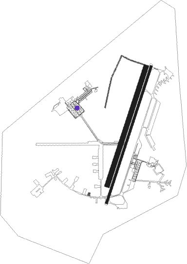
Zaporizhzhia - Zaporizhzhia Intl
Airport details
| Country | Ukraine |
| State | Zaporizhia Oblast |
| Region | UK |
| Airspace | Dnipro Ctr |
| Municipality | Zaporizhzhia |
| Elevation | 374ft (114m) |
| Timezone | GMT +2 |
| Coordinates | 47.86771, 35.31982 |
| Magnetic var | |
| Type | land |
| Available since | X-Plane v10.40 |
| ICAO code | UKDE |
| IATA code | OZH |
| FAA code | n/a |
Communication
| Zaporizhzhia Intl AWOS | 126.400 |
| Zaporizhzhia Intl Tower | 120.050 |
| Zaporizhzhia Intl Approach | 119.200 |
| Zaporizhzhia Intl Departure | 120.050 |
Approach frequencies
| ILS-cat-I | RW20 | 111.5 | 18.00mi |
| 3° GS | RW20 | 111.5 | 18.00mi |
Nearby Points of Interest:
Kirche in Tersianka
Runway info
Runway 02L / 20R  | ||
| length | 2160m (7087ft) | |
| bearing | 32° / 212° | |
| width | 85m (279ft) | |
| surface | grass | |
| Runway 02R / 20L | ||
| length | 2501m (8205ft) | |
| bearing | 32° / 212° | |
| width | 42m (138ft) | |
| surface | concrete | |
Nearby beacons
| code | identifier | dist | bearing | frequency |
|---|---|---|---|---|
| ZP | ZAPORIZHZHIA NDB | 1.1 | 21° | 608 |
| ZA | ZAPORIZHZHIA NDB | 3 | 216° | 295 |
| DR | DNIPRO NDB | 29.9 | 344° | 335 |
| R | DNIPRO NDB | 30.3 | 339° | 687 |
| DNP | DNIPRO VOR/DME | 30.8 | 336° | 112.50 |
| P | DNIPRO NDB | 31 | 333° | 687 |
| DP | DNIPRO NDB | 31.6 | 329° | 335 |
Departure and arrival routes
| Transition altitude | 3050ft |
| SID end points | distance | outbound heading | |
|---|---|---|---|
| RW02 | |||
| BULI2A | 37mi | 84° | |
| SOMO3A | 40mi | 127° | |
| ROLO5A | 39mi | 228° | |
| DITI4A | 50mi | 252° | |
| UMSO5A | 27mi | 275° | |
| ODNI3A | 31mi | 336° | |
| RW20 | |||
| BULI2B | 37mi | 84° | |
| SOMO2B | 40mi | 127° | |
| ROLO5B | 39mi | 228° | |
| DITI4B | 50mi | 252° | |
| UMSO5B | 27mi | 275° | |
| ODNI3B | 31mi | 336° | |
| STAR starting points | distance | inbound heading | |
|---|---|---|---|
| RW02 | |||
| ABDA6C | 40.3 | 5° | |
| ROLO4C | 38.7 | 48° | |
| DITI4C | 49.7 | 72° | |
| UMSO5C | 27.4 | 95° | |
| ODNI3C | 30.8 | 156° | |
| BULI2C | 36.5 | 264° | |
| SOMO2C | 40.4 | 307° | |
| RW20 | |||
| ABDA6D | 40.3 | 5° | |
| ROLO4D | 38.7 | 48° | |
| DITI4D | 49.7 | 72° | |
| UMSO5D | 27.4 | 95° | |
| ODNI3D | 30.8 | 156° | |
| BULI2D | 36.5 | 264° | |
| SOMO2D | 40.4 | 307° | |
Holding patterns
| STAR name | hold at | type | turn | heading* | altitude | leg | speed limit |
|---|---|---|---|---|---|---|---|
| ABDA6C | ZA | FIX | left | 35 (215)° | > 1970ft | 1.0min timed | ICAO rules |
| ABDA6D | ZP | FIX | left | 16 (196)° | > 1970ft | 1.0min timed | ICAO rules |
| BULI2C | ZA | FIX | left | 35 (215)° | > 1970ft | 1.0min timed | ICAO rules |
| BULI2D | ZP | FIX | left | 16 (196)° | > 1970ft | 1.0min timed | ICAO rules |
| DITI4C | ZA | FIX | left | 35 (215)° | > 1970ft | 1.0min timed | ICAO rules |
| DITI4D | ZP | FIX | left | 16 (196)° | > 1970ft | 1.0min timed | ICAO rules |
| ODNI3C | ZA | FIX | left | 35 (215)° | > 1970ft | 1.0min timed | ICAO rules |
| ODNI3D | ZP | FIX | left | 16 (196)° | > 1970ft | 1.0min timed | ICAO rules |
| ROLO4C | ZA | FIX | left | 35 (215)° | > 1970ft | 1.0min timed | ICAO rules |
| ROLO4D | ZP | FIX | left | 16 (196)° | > 1970ft | 1.0min timed | ICAO rules |
| SOMO2C | ZA | FIX | left | 35 (215)° | > 1970ft | 1.0min timed | ICAO rules |
| SOMO2D | ZP | FIX | left | 16 (196)° | > 1970ft | 1.0min timed | ICAO rules |
| UMSO5C | ZA | FIX | left | 35 (215)° | > 1970ft | 1.0min timed | ICAO rules |
| UMSO5D | ZP | FIX | left | 16 (196)° | > 1970ft | 1.0min timed | ICAO rules |
| *) magnetic outbound (inbound) holding course | |||||||
Disclaimer
The information on this website is not for real aviation. Use this data with the X-Plane flight simulator only! Data taken with kind consent from X-Plane 12 source code and data files. Content is subject to change without notice.