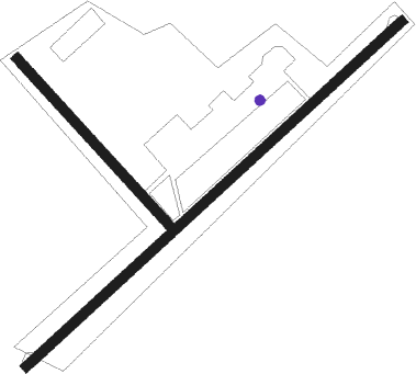
Kyzyl
Airport details
| Country | Russian Federation |
| State | Tuva Republic |
| Region | UN |
| Airspace | Krasnoyarsk Ctr |
| Municipality | Kyzyl |
| Elevation | 2142ft (653m) |
| Timezone | GMT +7 |
| Coordinates | 51.66945, 94.40056 |
| Magnetic var | |
| Type | land |
| Available since | X-Plane v10.40 |
| ICAO code | UNKY |
| IATA code | KYZ |
| FAA code | n/a |
Communication
| Kyzyl Kyzyl ATIS | 126.400 |
| Kyzyl Kyzyl Tower | 120.700 |
Approach frequencies
| ILS-cat-I | RW05 | 109.1 | 18.00mi |
| 3.5° GS | RW05 | 109.1 | 18.00mi |
Nearby beacons
| code | identifier | dist | bearing | frequency |
|---|---|---|---|---|
| P | KYZYL NDB | 1.2 | 64° | 996 |
| PS | KYZYL NDB | 2.8 | 64° | 490 |
| KZL | DME | 8.4 | 248° | 112.30 |
| TR | TURAN NDB | 34.2 | 314° | 980 |
Departure and arrival routes
| Transition altitude | 9688ft |
| Transition level | 11000ft |
| SID end points | distance | outbound heading | |
|---|---|---|---|
| RW05 | |||
| UDRE1X, UDRE1T, UDRE1W, UDRE1K, UDRE1F, UDRE1E | 29mi | 64° | |
| KENI1F, KENI1E, KENI1K, KENI1T, KENI1X, KENI1W | 18mi | 242° | |
| TR1F, TR1K, TR1X, TR1W, TR1T, TR1E | 34mi | 314° | |
| RW23 | |||
| UDRE1U, UDRE1S, UDRE1L, UDRE1H, UDRE1G, UDRE1V | 29mi | 64° | |
| KENI1V, KENI1G, KENI1H, KENI1L, KENI1S, KENI1U | 18mi | 242° | |
| TR1V, TR1S, TR1L, TR1H, TR1G, TR1U | 34mi | 314° | |
| STAR starting points | distance | inbound heading | |
|---|---|---|---|
| RW05 | |||
| KENI1A, KENI1B, KENI1C | 18.4 | 62° | |
| TR1A, TR1B, TR1C | 34.2 | 134° | |
| UDRE1Z, UDRE1C, UDRE1B, UDRE1A | 28.9 | 244° | |
| RW23 | |||
| KENI1Y, KENI1D, KENI1B, KENI1A | 18.4 | 62° | |
| TR1A, TR1B, TR1D | 34.2 | 134° | |
| UDRE1D, UDRE1B, UDRE1A | 28.9 | 244° | |
Instrument approach procedures
| runway | airway (heading) | route (dist, bearing) |
|---|---|---|
| RW05 | KY001 (19°) | KY001 7700ft KY002 (6mi, 244°) 5740ft KY005 (6mi, 309°) 5740ft |
| RW05 | KY003 (134°) | KY003 7870ft KY004 (13mi, 235°) 5740ft KY005 (5mi, 128°) 5740ft |
| RNAV | KY005 5740ft KY006 (6mi, 64°) 4420ft KY007 (6mi, 64°) 2303ft (5568mi, 241°) 2520ft KY008 (5576mi, 61°) KY001 (17mi, 226°) 7700ft | |
| RW23 | KY003 (134°) | KY003 8680ft KY014 (18mi, 70°) 8680ft KY013 (5mi, 129°) 8680ft |
| RW23 | KY013 (244°) | KY013 8680ft |
| RW23 | KY016 (279°) | KY016 8680ft KY015 (12mi, 49°) 8680ft KY013 (5mi, 309°) 8680ft |
| RNAV | KY013 8680ft KY017 (4mi, 244°) 7210ft KY018 (2mi, 244°) 6390ft KY019 (3mi, 244°) 5240ft KY009 (2mi, 244°) 4420ft 28NM (3mi, 244°) 3430ft KY010 (3mi, 244°) 2394ft (5570mi, 241°) 2510ft KY011 (5560mi, 61°) KY012 (9mi, 129°) KY016 (18mi, 64°) 8680ft |
Holding patterns
| STAR name | hold at | type | turn | heading* | altitude | leg | speed limit |
|---|---|---|---|---|---|---|---|
| KENI1A | PS | FIX | right | 230 (50)° | 7700ft - 14000ft | 1.0min timed | 205 |
| KENI1B | P | FIX | left | 2 (182)° | 1.0min timed | ICAO rules | |
| KENI1C | KY001 | VHF | left | 50 (230)° | 7700ft - 14000ft | 1.0min timed | 270 |
| KENI1D | KY016 | VHF | right | 213 (33)° | 8680ft - 14000ft | 1.0min timed | ICAO rules |
| TR1A | PS | FIX | right | 230 (50)° | 7700ft - 14000ft | 1.0min timed | 205 |
| TR1B | P | FIX | left | 2 (182)° | 1.0min timed | ICAO rules | |
| UDRE1A | PS | FIX | right | 230 (50)° | 7700ft - 14000ft | 1.0min timed | 205 |
| UDRE1B | P | FIX | left | 2 (182)° | 1.0min timed | ICAO rules | |
| UDRE1D | KY013 | VHF | left | 50 (230)° | 8680ft - 13000ft | 1.0min timed | 200 |
| UDRE1Z | KY001 | VHF | left | 50 (230)° | 7700ft - 14000ft | 1.0min timed | 270 |
| *) magnetic outbound (inbound) holding course | |||||||
Disclaimer
The information on this website is not for real aviation. Use this data with the X-Plane flight simulator only! Data taken with kind consent from X-Plane 12 source code and data files. Content is subject to change without notice.

