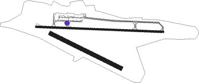
Astrakhan
Airport details
| Country | Russian Federation |
| State | Astrakhan Oblast |
| Region | UR |
| Airspace | Rostov-na-donu Ctr |
| Municipality | сельское поселение Село Карагали |
| Elevation | -62ft (-19m) |
| Timezone | GMT +4 |
| Coordinates | 46.28333, 48.00639 |
| Magnetic var | |
| Type | land |
| Available since | X-Plane v10.40 |
| ICAO code | URWA |
| IATA code | ASF |
| FAA code | n/a |
Communication
| Astrakhan ATIS | 125.625 |
| Astrakhan Tower | 118.600 |
| Astrakhan Approach | 126.000 |
Approach frequencies
| ILS-cat-I | RW27 | 110.5 | 18.00mi |
| ILS-cat-I | RW09 | 110.3 | 18.00mi |
| 3° GS | RW27 | 110.5 | 18.00mi |
| 3° GS | RW09 | 110.3 | 18.00mi |
Nearby beacons
| code | identifier | dist | bearing | frequency |
|---|---|---|---|---|
| AST | ASTRAKHAN VOR/DME | 0.1 | 128° | 116.10 |
| G | ASTRAKHAN NDB | 1.1 | 275° | 315 |
| GV | ASTRAKHAN NDB | 2.7 | 275° | 650 |
| ZG | ZELENGA NDB | 25.3 | 99° | 905 |
| UP | ZENZELI NDB | 44.8 | 249° | 337 |
| ZNL | DME | 44.8 | 249° | 113.60 |
Departure and arrival routes
| Transition altitude | 1906ft |
| Transition level | 4000ft |
| SID end points | distance | outbound heading | |
|---|---|---|---|
| RW09 | |||
| UP1B, UP1A | 45mi | 249° | |
| BASK1B, BASK1A | 48mi | 266° | |
| OMIR1A | 46mi | 294° | |
| RW27 | |||
| UP3A | 45mi | 249° | |
| BASK3A | 48mi | 266° | |
| OMIR3A, OMIR3B | 46mi | 294° | |
| STAR starting points | distance | inbound heading | |
|---|---|---|---|
| RW09 | |||
| UP4A, UP4B | 44.8 | 69° | |
| OMIR4A, OMIR4B | 45.8 | 114° | |
| RW27 | |||
| UP2B, UP2A | 44.8 | 69° | |
| OMIR2B, OMIR2A | 45.8 | 114° | |
Holding patterns
| STAR name | hold at | type | turn | heading* | altitude | leg | speed limit |
|---|---|---|---|---|---|---|---|
| UP2A | UP | FIX | right | 233 (53)° | 1.0min timed | ICAO rules | |
| UP2B | UP | FIX | right | 233 (53)° | 1.0min timed | ICAO rules | |
| UP4A | UP | FIX | right | 233 (53)° | 1.0min timed | ICAO rules | |
| UP4B | UP | FIX | right | 233 (53)° | 1.0min timed | ICAO rules | |
| ZG2A | ZG | FIX | left | 95 (275)° | 1.0min timed | ICAO rules | |
| ZG2B | ZG | FIX | left | 95 (275)° | 1.0min timed | ICAO rules | |
| ZG4A | ZG | FIX | left | 95 (275)° | 1.0min timed | ICAO rules | |
| ZG4B | ZG | FIX | left | 95 (275)° | 1.0min timed | ICAO rules | |
| *) magnetic outbound (inbound) holding course | |||||||
Disclaimer
The information on this website is not for real aviation. Use this data with the X-Plane flight simulator only! Data taken with kind consent from X-Plane 12 source code and data files. Content is subject to change without notice.

