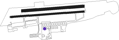
Airports for X-Plane offers a convenient way to explore airports and their related communication information for the X-Plane flight simulator. It only uses data from the X-Plane flight simulator itself, and is therefore more reliable than the data that comes from real aviation websites. You can search for airports by using the ICAO code, or browse for airports per country and state. The information displayed is categorized by airport details, runway information, airport communication, approach frequencies (ILS and Glidepath details), details of nearby beacons, SIDs, STARs and approach procedures.

airliner luggage air safety airfield faa passengers flown outskirts runway lighting aerodromes control tower train hospital military passenger buildings takeoff nation taxiway runway

Sverdlovsk - Aramil

Airport details

CountryRussian Federation
StateSverdlovsk Oblast
Region
AirspaceYekaterinburg Ctr
MunicipalitySysertsky District
Elevation643ft (196m)
TimezoneGMT +5
Coordinates56.70167, 60.79167
Magnetic var
Typeland
Available sinceX-Plane v10.32
ICAO codeUSSK
IATA coden/a
FAA coden/a

Communication

Aramil ATIS129.700
Aramil Antikwar Tower132.000
Nearby Points of Interest:
Lower Iset Works Direction Building
-
Sports and Technology Club, Yekaterinburg
-
Uktussky bridge
-
Church of Saint Elisabeth, Yekaterinburg
-
Church Of Michael The Archangel, Ekaterinburg
-
Old Believers church of Saint Nicholas (Yekaterinburg)
-
Trinity Church of the same faith
-
Central Library named after A. I. Herzen
-
Hospital of Emergency Medical Service, Yekaterinburg
-
Zheleznov's mansion
-
Diocesan School, Yekaterinburg
-
Church of the Exaltation of the Holy Cross in Yekaterinburg
-
Category:8 March street 62, Yekaterinburg
-
Ural Federal University
-
Ural State Technical University
-
Filitz Mansion, Yekaterinburg
-
Sverdlovsk regional universal scientific library named after V. G. Belinsky
-
Church Of St. Nicholas
-
Gospromural building estate
-
House of Merchant Babikov
-
House of rittmeister Pereyaslavtsev, Yekaterinburg
-
Volga-Ural Military District headquarters
-
First Gymnasium for girls

Runway info

Runway 08 / 26  
 length1805m (5922ft)
 bearing90° / 270°
 width40m (131ft)
 surfaceasphalt
 displ threshold7m (23ft) / 7m (23ft)
Runway 08L / 26R  
 length1501m (4925ft)
 bearing90° / 270°
 width70m (230ft)
 surfacegrass

Nearby beacons

codeidentifierdistbearingfrequency
EKBKOLTSOVO (YEKATERINBURG) VOR/DME2.4113.20
DKOLTSOVO (YEKATERINBURG) NDB2.853°388
UKOLTSOVO (YEKATERINBURG) NDB348°749

Disclaimer

The information on this website is not for real aviation. Use this data with the X-Plane flight simulator only! Data taken with kind consent from X-Plane 12 source code and data files. Content is subject to change without notice.