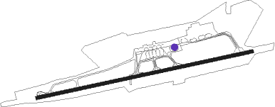
Khudzhand
Airport details
| Country | Tajikistan |
| State | Sughd Region |
| Region | UT |
| Airspace | Dushanbe Ctr |
| Municipality | Ghafurov District |
| Elevation | 1450ft (442m) |
| Timezone | GMT +5 |
| Coordinates | 40.21500, 69.69666 |
| Magnetic var | |
| Type | land |
| Available since | X-Plane v10.40 |
| ICAO code | UTDL |
| IATA code | LBD |
| FAA code | n/a |
Communication
| Khudzhand Tower | 120.300 |
Approach frequencies
| ILS-cat-I | RW08 | 111.5 | 18.00mi |
| ILS-cat-I | RW26 | 109.9 | 18.00mi |
| 3° GS | RW08 | 111.5 | 18.00mi |
| 2.6° GS | RW26 | 109.9 | 18.00mi |
Runway info
| Runway 08 / 26 | ||
| length | 3288m (10787ft) | |
| bearing | 84° / 264° | |
| width | 50m (164ft) | |
| surface | asphalt | |
| displ threshold | 0m (0ft) / 292m (958ft) | |
| blast zone | 110m (361ft) / 80m (262ft) | |
Nearby beacons
| code | identifier | dist | bearing | frequency |
|---|---|---|---|---|
| HND | DME | 0.2 | 101° | 114.30 |
| D | KHUJAND NDB | 1.1 | 266° | 318 |
| V | KHUJAND NDB | 1.1 | 82° | 318 |
| HD | KHUJAND NDB | 2.7 | 264° | 655 |
| HV | KHUJAND NDB | 2.8 | 84° | 655 |
| IRN | DME | 35.7 | 258° | 113.90 |
| PF | URA-TYUBE NDB | 35.7 | 258° | 385 |
| SR | SERGELI NDB | 62.1 | 334° | 743 |
Departure and arrival routes
| Transition altitude | 6371ft |
| Transition level | 8000ft |
| SID end points | distance | outbound heading | |
|---|---|---|---|
| RW08 | |||
| KEGIB1 | 34mi | 79° | |
| DILRO1 | 22mi | 295° | |
| RW26 | |||
| KEGIB3 | 34mi | 79° | |
| DILR3A, DILRO3 | 22mi | 295° | |
| STAR starting points | distance | inbound heading | |
|---|---|---|---|
| RW08 | |||
| DILR2A, DILRO2 | 22.4 | 115° | |
| KEGI2A, KEGIB2 | 34.1 | 259° | |
| RW26 | |||
| DILRO4 | 22.4 | 115° | |
| KEGIB4, KEGI4A | 34.1 | 259° | |
Disclaimer
The information on this website is not for real aviation. Use this data with the X-Plane flight simulator only! Data taken with kind consent from X-Plane 12 source code and data files. Content is subject to change without notice.
