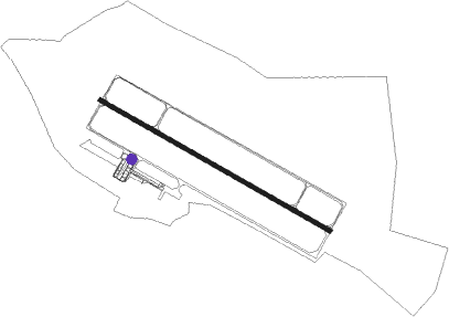
Kursk
Airport details
| Country | Russian Federation |
| State | Kursk Oblast |
| Region | UU |
| Airspace | Moscow Ctr |
| Municipality | Клюквинский сельсовет |
| Elevation | 686ft (209m) |
| Timezone | GMT +3 |
| Coordinates | 51.75199, 36.28469 |
| Magnetic var | |
| Type | land |
| Available since | X-Plane v10.40 |
| ICAO code | UUOK |
| IATA code | URS |
| FAA code | n/a |
Communication
| Kursk TAXIING | 120.600 |
| Kursk START | 131.500 |
| Kursk KRUG | 131.500 |
Approach frequencies
| ILS-cat-I | RW30 | 110.3 | 18.00mi |
| 3° GS | RW30 | 110.3 | 18.00mi |
Nearby beacons
| code | identifier | dist | bearing | frequency |
|---|---|---|---|---|
| G | VOSTOCHNY (KURSK) NDB | 0.8 | 301° | 368 |
| W | VOSTOCHNY (KURSK) NDB | 1.6 | 109° | 368 |
| GE | VOSTOCHNY (KURSK) NDB | 2.4 | 295° | 742 |
| WA | VOSTOCHNY (KURSK) NDB | 3.1 | 111° | 742 |
| KY | DME | 61.1 | 331° | 110.20 |
Departure and arrival routes
| Transition altitude | 3638ft |
| Transition level | 4921ft |
| SID end points | distance | outbound heading | |
|---|---|---|---|
| RW12 | |||
| OBES1J | 26mi | 78° | |
| LULE1J | 35mi | 203° | |
| ULNE1J | 41mi | 352° | |
| RW30 | |||
| OBES1L | 26mi | 78° | |
| LULE1L | 35mi | 203° | |
| ULNE1L | 41mi | 352° | |
| STAR starting points | distance | inbound heading | |
|---|---|---|---|
| RW12 | |||
| ULNE1Y, ULNE1Z | 40.9 | 172° | |
| OBES1E, OBES1F | 25.8 | 258° | |
| AMKA1A, AMKA1B | 29.3 | 299° | |
| RW30 | |||
| ULNE1H, ULNE1G | 40.9 | 172° | |
| OBES1H, OBES1G | 25.8 | 258° | |
| AMKA1H, AMKA1G | 29.3 | 299° | |
Holding patterns
| STAR name | hold at | type | turn | heading* | altitude | leg | speed limit |
|---|---|---|---|---|---|---|---|
| AMKA1A | GE | FIX | left | 296 (116)° | 6000ft - 9000ft | 1.0min timed | 230 |
| AMKA1B | G | NDB | right | 134 (314)° | > 2300ft | 1.0min timed | 230 |
| AMKA1G | WA | FIX | right | 116 (296)° | 6000ft - 9000ft | 1.0min timed | 230 |
| AMKA1H | W | FIX | left | 1 (181)° | 5000ft - 53000ft | 1.0min timed | ICAO rules |
| OBES1E | GE | FIX | left | 296 (116)° | 6000ft - 9000ft | 1.0min timed | 230 |
| OBES1F | G | NDB | right | 134 (314)° | > 2300ft | 1.0min timed | 230 |
| OBES1G | WA | FIX | right | 116 (296)° | 6000ft - 9000ft | 1.0min timed | 230 |
| OBES1H | W | FIX | left | 1 (181)° | 5000ft - 53000ft | 1.0min timed | ICAO rules |
| ULNE1G | WA | FIX | right | 116 (296)° | 6000ft - 9000ft | 1.0min timed | 230 |
| ULNE1H | W | FIX | left | 1 (181)° | 5000ft - 53000ft | 1.0min timed | ICAO rules |
| ULNE1Y | GE | FIX | left | 296 (116)° | 6000ft - 9000ft | 1.0min timed | 230 |
| ULNE1Z | G | NDB | right | 134 (314)° | > 2300ft | 1.0min timed | 230 |
| *) magnetic outbound (inbound) holding course | |||||||
Disclaimer
The information on this website is not for real aviation. Use this data with the X-Plane flight simulator only! Data taken with kind consent from X-Plane 12 source code and data files. Content is subject to change without notice.
