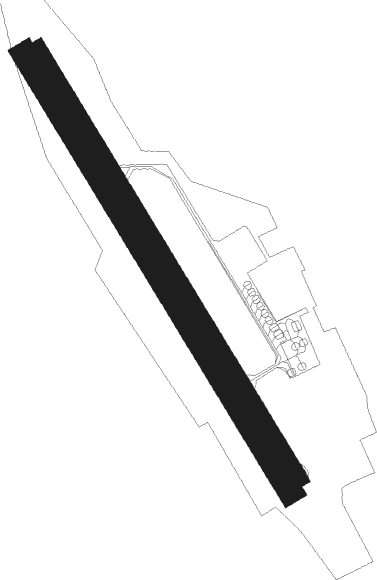
Tambov - Donskoe
Airport details
| Country | Russian Federation |
| State | Tambov Oblast |
| Region | UU |
| Airspace | Moscow Ctr |
| Municipality | Донской сельсовет |
| Elevation | 416ft (127m) |
| Timezone | GMT +3 |
| Coordinates | 52.80643, 41.48273 |
| Magnetic var | |
| Type | land |
| Available since | X-Plane v11.05 |
| ICAO code | UUOT |
| IATA code | TBW |
| FAA code | n/a |
Communication
| DONSKOE Tower | 120.700 |
| DONSKOE Approach | 124.600 |
Nearby beacons
| code | identifier | dist | bearing | frequency |
|---|---|---|---|---|
| F | DONSKOE (TAMBOV) NDB | 1 | 320° | 362 |
| X | DONSKOE (TAMBOV) NDB | 1 | 140° | 362 |
| XV | DONSKOE (TAMBOV) NDB | 3 | 141° | 735 |
| FF | DONSKOE (TAMBOV) NDB | 3.1 | 320° | 735 |
| AL | ALGASOVO NDB | 52.9 | 13° | 694 |
| AO | DME | 52.9 | 13° | 115.30 |
Departure and arrival routes
| Transition altitude | 3050ft |
| Transition level | 5000ft |
| SID end points | distance | outbound heading | |
|---|---|---|---|
| RW14 | |||
| TAMA1E | 30mi | 58° | |
| UMRA1Z, UMRA1E | 31mi | 133° | |
| LAMK1E | 26mi | 333° | |
| RW32 | |||
| TAMA1F | 30mi | 58° | |
| UMRA1F, UMRA1Y | 31mi | 133° | |
| LAMK1F | 26mi | 333° | |
| STAR starting points | distance | inbound heading | |
|---|---|---|---|
| RW14 | |||
| LAMK1G | 26.4 | 153° | |
| TAMA1G | 29.9 | 238° | |
| UMRA1G, UMRA1X | 31.2 | 313° | |
| RW32 | |||
| LAMK1H | 26.4 | 153° | |
| TAMA1H | 29.9 | 238° | |
| UMRA1H, UMRA1W | 31.2 | 313° | |
Holding patterns
| STAR name | hold at | type | turn | heading* | altitude | leg | speed limit |
|---|---|---|---|---|---|---|---|
| LAMK1G | F | FIX | left | 58 (238)° | 6000ft - 53000ft | 1.0min timed | ICAO rules |
| LAMK1H | X | FIX | right | 142 (322)° | 2800ft - 10000ft | 1.0min timed | 230 |
| TAMA1G | F | FIX | left | 58 (238)° | 6000ft - 53000ft | 1.0min timed | ICAO rules |
| TAMA1H | X | FIX | right | 142 (322)° | 2800ft - 10000ft | 1.0min timed | 230 |
| UMRA1G | F | FIX | left | 58 (238)° | 6000ft - 53000ft | 1.0min timed | ICAO rules |
| UMRA1H | X | FIX | right | 142 (322)° | 2800ft - 10000ft | 1.0min timed | 230 |
| UMRA1W | X | FIX | right | 142 (322)° | 2800ft - 10000ft | 1.0min timed | 230 |
| UMRA1X | F | FIX | left | 58 (238)° | 6000ft - 53000ft | 1.0min timed | ICAO rules |
| *) magnetic outbound (inbound) holding course | |||||||
Disclaimer
The information on this website is not for real aviation. Use this data with the X-Plane flight simulator only! Data taken with kind consent from X-Plane 12 source code and data files. Content is subject to change without notice.

