Bugulma
Airport details
| Country | Russian Federation |
| State | Tatarstan |
| Region | UW |
| Airspace | Samara Ctr |
| Municipality | Подгорненское сельское поселение |
| Elevation | 990ft (302m) |
| Timezone | GMT +3 |
| Coordinates | 54.64139, 52.80056 |
| Magnetic var | |
| Type | land |
| Available since | X-Plane v10.40 |
| ICAO code | UWKB |
| IATA code | UUA |
| FAA code | n/a |
Communication
| Bugulma Tower | 119.700 |
Approach frequencies
| ILS-cat-I | RW19 | 110.9 | 18.00mi |
| 3° GS | RW19 | 110.9 | 18.00mi |
Nearby Points of Interest:
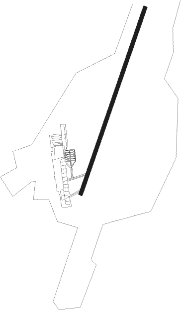
Runway info
| Runway 01 / 19 | ||
| length | 2014m (6608ft) | |
| bearing | 37° / 217° | |
| width | 40m (131ft) | |
| surface | asphalt | |
Nearby beacons
| code | identifier | dist | bearing | frequency |
|---|---|---|---|---|
| IBV | DME-ILS | 1 | 217° | 109.50 |
| M | BUGULMA NDB | 1 | 217° | 672 |
| MC | BUGULMA NDB | 2.5 | 217° | 325 |
| LB | BUGULMA NDB | 3 | 37° | 325 |
| SG | OCTYABRSKY NDB | 23.8 | 110° | 348 |
| NA | BEGISHEVO NDB | 59.7 | 319° | 370 |
| A | BEGISHEVO (NIZHNEKAMSK) NDB | 60.1 | 321° | 749 |
| BGS | BEGISHEVO VOR/DME | 60.5 | 322° | 111.60 |
| K | BEGISHEVO (NIZHNEKAMSK) NDB | 60.9 | 324° | 749 |
| NK | BEGISHEVO NDB | 61.5 | 326° | 370 |
Departure and arrival routes
| Transition altitude | 2960ft |
| SID end points | distance | outbound heading | |
|---|---|---|---|
| RW01 | |||
| URARI1, URAR1M | 21mi | 72° | |
| UNLO1M, UNLOP1 | 24mi | 82° | |
| RAFI1M, RAFIK1 | 26mi | 99° | |
| DIDUN1, DIDU1M | 22mi | 169° | |
| FARDA1, FARD1M | 22mi | 216° | |
| LEKB1M, LEKBO1 | 72mi | 289° | |
| ATKA1M, ATKAM1 | 24mi | 353° | |
| RW19 | |||
| URAR2L, URARI2 | 21mi | 72° | |
| UNLOP2, UNLO2L | 24mi | 82° | |
| RAFIK2, RAFI2L | 26mi | 99° | |
| DIDUN2, DIDU2L | 22mi | 169° | |
| FARDA2, FARD2L | 22mi | 216° | |
| LEKBO2, LEKB2L | 72mi | 289° | |
| ATKAM2, ATKA2L | 24mi | 353° | |
| STAR starting points | distance | inbound heading | |
|---|---|---|---|
| RW01 | |||
| KODZI3, KODZ3M | 21.5 | 66° | |
| NILFA3, NILF3M | 21.5 | 78° | |
| AMEL3M, AMELO3 | 23.2 | 102° | |
| ATKA3M, ATKAM3 | 23.7 | 173° | |
| UNBU3M, UNBUS3 | 25.1 | 236° | |
| UNLO3M, UNLOP3 | 23.5 | 262° | |
| DIDUN3, DIDU3M | 21.5 | 349° | |
| RW19 | |||
| KODZI4, KODZ4L | 21.5 | 66° | |
| NILFA4, NILF4L | 21.5 | 78° | |
| AMELO4, AMEL4L | 23.2 | 102° | |
| ATKA4L, ATKAM4 | 23.7 | 173° | |
| UNBU4L, UNBUS4 | 25.1 | 236° | |
| UNLOP4, UNLO4L | 23.5 | 262° | |
| DIDUN4, DIDU4L | 21.5 | 349° | |
Holding patterns
| STAR name | hold at | type | turn | heading* | altitude | leg | speed limit |
|---|---|---|---|---|---|---|---|
| AMEL3M | MC | FIX | right | 190 (10)° | 7000ft - 20000ft | 1.0min timed | ICAO rules |
| AMEL4L | LB | FIX | left | 10 (190)° | 7000ft - 20000ft | 1.0min timed | ICAO rules |
| ATKA3M | MC | FIX | right | 190 (10)° | 7000ft - 20000ft | 1.0min timed | ICAO rules |
| ATKA4L | LB | FIX | left | 10 (190)° | 7000ft - 20000ft | 1.0min timed | ICAO rules |
| DIDU3M | MC | FIX | right | 190 (10)° | 7000ft - 20000ft | 1.0min timed | ICAO rules |
| DIDU4L | LB | FIX | left | 10 (190)° | 7000ft - 20000ft | 1.0min timed | ICAO rules |
| KODZ3M | MC | FIX | right | 190 (10)° | 7000ft - 20000ft | 1.0min timed | ICAO rules |
| KODZ4L | LB | FIX | left | 10 (190)° | 7000ft - 20000ft | 1.0min timed | ICAO rules |
| NILF3M | MC | FIX | right | 190 (10)° | 7000ft - 20000ft | 1.0min timed | ICAO rules |
| NILF4L | LB | FIX | left | 10 (190)° | 7000ft - 20000ft | 1.0min timed | ICAO rules |
| UNBU3M | MC | FIX | right | 190 (10)° | 7000ft - 20000ft | 1.0min timed | ICAO rules |
| UNBU4L | LB | FIX | left | 10 (190)° | 7000ft - 20000ft | 1.0min timed | ICAO rules |
| UNLO3M | MC | FIX | right | 190 (10)° | 7000ft - 20000ft | 1.0min timed | ICAO rules |
| UNLO4L | LB | FIX | left | 10 (190)° | 7000ft - 20000ft | 1.0min timed | ICAO rules |
| *) magnetic outbound (inbound) holding course | |||||||
Disclaimer
The information on this website is not for real aviation. Use this data with the X-Plane flight simulator only! Data taken with kind consent from X-Plane 12 source code and data files. Content is subject to change without notice.