Kazan
Airport details
| Country | Russian Federation |
| State | Tatarstan |
| Region | UW |
| Airspace | Samara Ctr |
| Municipality | Столбищенское сельское поселение |
| Elevation | 411ft (125m) |
| Timezone | GMT +3 |
| Coordinates | 55.60695, 49.28028 |
| Magnetic var | |
| Type | land |
| Available since | X-Plane v10.40 |
| ICAO code | UWKD |
| IATA code | KZN |
| FAA code | n/a |
Communication
| Kazan ATIS | 126.800 |
| Kazan TAXIING | 121.700 |
| Kazan Tower | 120.300 |
| Kazan RADAR | 124.000 |
| Kazan RADAR | 119.400 |
| Kazan RADAR | 129.000 |
Approach frequencies
| ILS-cat-II | RW11 | 110.5 | 18.00mi |
| ILS-cat-I | RW29 | 111.7 | 18.00mi |
| 3° GS | RW11 | 110.5 | 18.00mi |
| 3° GS | RW29 | 111.7 | 18.00mi |
Nearby Points of Interest:
Ascension Monastery, Kazan
-Tatarstan Street 14, Kazan
-Mukhammadia
-Kazan Art College
-Buildings of Kazan University
-Karetnikov House, Kazan
-Klyachkin clinics
-Zemlyanoy House (Kazan)
-Category:Sveshnikov house (Kazan, Kavi Nadzhmi street)
-Mergasov House
-Trade arcade complex, Kazan
-Trade Arcade, Kazan
-Checkmaryov (Kamenev) House, Kazan
-Kazansky Bogoroditsky Monastery
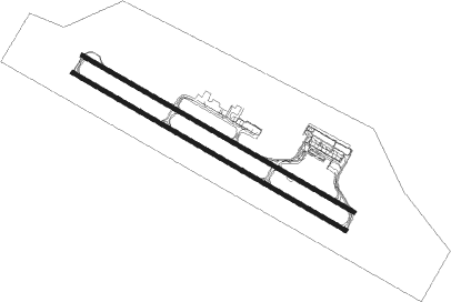
Runway info
Runway 11L / 29R  | ||
| length | 3717m (12195ft) | |
| bearing | 111° / 291° | |
| width | 44m (144ft) | |
| surface | concrete | |
| displ threshold | 255m (837ft) / 0m (0ft) | |
| blast zone | 0m (0ft) / 48m (157ft) | |
| Runway 11 / 29 | ||
| length | 3746m (12290ft) | |
| bearing | 111° / 291° | |
| width | 45m (148ft) | |
| surface | concrete | |
| blast zone | 72m (236ft) / 72m (236ft) | |
Nearby beacons
| code | identifier | dist | bearing | frequency |
|---|---|---|---|---|
| KZN | KAZAN VOR/DME | 0.2 | 260° | 112.70 |
| BL | KAZAN NDB | 1.4 | 113° | 965 |
| AM | KAZAN NDB | 1.7 | 290° | 475 |
| PS | KAZAN NDB | 3 | 292° | 292 |
| RD | MATAKI DME | 48.4 | 138° | 115.65 |
| RD | BAZARNYYE-MATAKI NDB | 48.5 | 139° | 445 |
Departure and arrival routes
| Transition altitude | 3363ft |
| SID end points | distance | outbound heading | |
|---|---|---|---|
| RW11 | |||
| RIMI1G, RIMI1D, RIMI1A | 27mi | 88° | |
| INTA1A, INTA1D, INTA1G | 27mi | 118° | |
| SONU1G, SONU1D, SONU1A | 27mi | 201° | |
| APTA1A, APTA1D, APTA1G | 27mi | 258° | |
| RW29 | |||
| RIMI1J, RIMI1E, RIMI1B, RIMI1H | 27mi | 88° | |
| INTA1B, INTA1E, INTA1H | 27mi | 118° | |
| SONU1C, SONU1B, SONU1F, SONU1J, SONU1H, SONU1E | 27mi | 201° | |
| APTA1B, APTA1H, APTA1E | 27mi | 258° | |
| STAR starting points | distance | inbound heading | |
|---|---|---|---|
| RW11 | |||
| SONU1S, SONU1R, SONU1P, SONU1M, SONU1K | 26.9 | 21° | |
| KORO1K, KORO1M, KORO1P, KORO1R | 26.9 | 91° | |
| ORTI1R, ORTI1P, ORTI1M, ORTI1K | 26.9 | 288° | |
| TONS1R, TONS1P, TONS1M, TONS1K | 26.9 | 336° | |
| RW29 | |||
| SONU1N, SONU1Q, SONU1T, SONU1L | 26.9 | 21° | |
| KORO1Q, KORO1N, KORO1L, KORO1T | 26.9 | 91° | |
| ORTI1T, ORTI1N, ORTI1L | 26.9 | 288° | |
| TONS1T, TONS1Q, TONS1N, TONS1L | 26.9 | 336° | |
Instrument approach procedures
| runway | airway (heading) | route (dist, bearing) |
|---|---|---|
| RW11 | KD001 (93°) | KD001 4000ft KD002 (6mi, 50°) 2700ft |
| RNAV | KD002 2700ft KD003 (6mi, 111°) 1700ft KD004 (3mi, 111°) 632ft KD005 (4mi, 111°) KD006 (10mi, 268°) KD001 (6mi, 291°) 2000ft KD001 (turn) 2000ft | |
| RW29 | KD007 (319°) | KD007 4000ft KD009 (6mi, 50°) 2700ft |
| RW29 | KD008 (291°) | KD008 4000ft KD009 (6mi, 291°) 2700ft |
| RNAV | KD009 2700ft KD010 (6mi, 291°) 1700ft KD011 (3mi, 291°) 598ft KD012 (4mi, 291°) KD013 (10mi, 149°) KD007 (6mi, 111°) 4000ft KD007 (turn) 4000ft |
Holding patterns
| STAR name | hold at | type | turn | heading* | altitude | leg | speed limit |
|---|---|---|---|---|---|---|---|
| KORO1K | AM | FIX | left | 119 (299)° | 3100ft - 7000ft | 1.0min timed | 190 |
| KORO1L | BL | FIX | left | 119 (299)° | 3100ft - 7000ft | 1.0min timed | 190 |
| KORO1M | KZN | NDB | left | 129 (309)° | 3100ft - 7000ft | 1.0min timed | 190 |
| KORO1N | KZN | NDB | left | 129 (309)° | 3100ft - 7000ft | 1.0min timed | 190 |
| KORO1Q | D260J | VHF | right | 259 (79)° | 2000ft - 7000ft | DME 5.0mi | 200 |
| KORO1R | KD001 | VHF | left | 201 (21)° | 2000ft - 7000ft | 1.0min timed | 185 |
| KORO1T | KD007 | VHF | right | 201 (21)° | 4000ft - 7000ft | 1.0min timed | ICAO rules |
| ORTI1K | AM | FIX | left | 119 (299)° | 3100ft - 7000ft | 1.0min timed | 190 |
| ORTI1L | BL | FIX | left | 119 (299)° | 3100ft - 7000ft | 1.0min timed | 190 |
| ORTI1M | KZN | NDB | left | 129 (309)° | 3100ft - 7000ft | 1.0min timed | 190 |
| ORTI1N | KZN | NDB | left | 129 (309)° | 3100ft - 7000ft | 1.0min timed | 190 |
| ORTI1P | D105J | VHF | left | 105 (285)° | 2200ft - 7000ft | DME 5.8mi | 240 |
| ORTI1R | KD001 | VHF | left | 201 (21)° | 2000ft - 7000ft | 1.0min timed | 185 |
| SONU1K | AM | FIX | left | 119 (299)° | 3100ft - 7000ft | 1.0min timed | 190 |
| SONU1L | BL | FIX | left | 119 (299)° | 3100ft - 7000ft | 1.0min timed | 190 |
| SONU1M | KZN | NDB | left | 129 (309)° | 3100ft - 7000ft | 1.0min timed | 190 |
| SONU1N | KZN | NDB | left | 129 (309)° | 3100ft - 7000ft | 1.0min timed | 190 |
| SONU1R | KD001 | VHF | left | 201 (21)° | 2000ft - 7000ft | 1.0min timed | 185 |
| SONU1S | KD001 | VHF | left | 201 (21)° | 2000ft - 7000ft | 1.0min timed | 185 |
| SONU1T | KD007 | VHF | right | 201 (21)° | 4000ft - 7000ft | 1.0min timed | ICAO rules |
| TONS1K | AM | FIX | left | 119 (299)° | 3100ft - 7000ft | 1.0min timed | 190 |
| TONS1L | BL | FIX | left | 119 (299)° | 3100ft - 7000ft | 1.0min timed | 190 |
| TONS1M | KZN | NDB | left | 129 (309)° | 3100ft - 7000ft | 1.0min timed | 190 |
| TONS1N | KZN | NDB | left | 129 (309)° | 3100ft - 7000ft | 1.0min timed | 190 |
| TONS1R | KD001 | VHF | left | 201 (21)° | 2000ft - 7000ft | 1.0min timed | 185 |
| *) magnetic outbound (inbound) holding course | |||||||
Disclaimer
The information on this website is not for real aviation. Use this data with the X-Plane flight simulator only! Data taken with kind consent from X-Plane 12 source code and data files. Content is subject to change without notice.