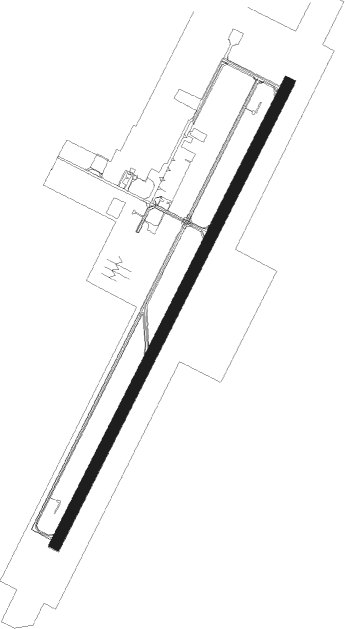
Ulyanovsk - Vostochny
Airport details
| Country | Russian Federation |
| State | Ulyanovsk Oblast |
| Region | UW |
| Airspace | Samara Ctr |
| Municipality | Мирновское сельское поселение |
| Elevation | 250ft (76m) |
| Timezone | GMT +4 |
| Coordinates | 54.41040, 48.79829 |
| Magnetic var | |
| Type | land |
| Available since | X-Plane v10.40 |
| ICAO code | UWLW |
| IATA code | ULY |
| FAA code | n/a |
Communication
| VOSTOCHNY Tower | 124.200 |
| VOSTOCHNY ULYANOVSK Approach | 127.300 |
| VOSTOCHNY KRUG | 126.100 |
Approach frequencies
| ILS-cat-I | RW02 | 110.1 | 18.00mi |
| ILS-cat-I | RW20 | 110.1 | 18.00mi |
| 2.6° GS | RW02 | 110.1 | 18.00mi |
| 2.6° GS | RW20 | 110.1 | 18.00mi |
Nearby beacons
| code | identifier | dist | bearing | frequency |
|---|---|---|---|---|
| UWS | ULYANOVSK VOR/DME | 0.6 | 127° | 113.70 |
| W | VOSTOCHNY (ULYANOVSK) NDB | 1.5 | 62° | 830 |
| U | VOSTOCHNY (ULYANOVSK) NDB | 2.2 | 213° | 830 |
| WN | VOSTOCHNY (ULYANOVSK) NDB | 3.2 | 54° | 408 |
| UL | VOSTOCHNY (ULYANOVSK) NDB | 3.8 | 219° | 408 |
| LS | BARATAYEVKA (ULYANOVSK) NDB | 19.3 | 260° | 332 |
| L | BARATAYEVKA (ULYANOVSK) NDB | 20.6 | 258° | 680 |
| BMK | ULYANOVSK-BARATAYEVKA VOR/DME | 21.9 | 256° | 113.40 |
| M | BARATAYEVKA (ULYANOVSK) NDB | 22.8 | 255° | 680 |
| DW | NIKOLSKOYE NDB | 25.8 | 134° | 995 |
| NK | DME-ILS | 25.9 | 134° | 108.10 |
Departure and arrival routes
| Transition altitude | 3205ft |
| SID end points | distance | outbound heading | |
|---|---|---|---|
| RW02 | |||
| ROMT2D | 36mi | 68° | |
| RUBE2D | 39mi | 174° | |
| NEPN2D | 54mi | 233° | |
| TERD2D | 69mi | 265° | |
| MOKE2D | 33mi | 311° | |
| RW20 | |||
| ROMT3D | 36mi | 68° | |
| RUBE3D | 39mi | 174° | |
| NEPN3D | 54mi | 233° | |
| TERD3D | 69mi | 265° | |
| MOKE3D | 33mi | 311° | |
| STAR starting points | distance | inbound heading | |
|---|---|---|---|
| RW02 | |||
| EREL2A | 47.2 | 57° | |
| MEZE2A | 54.5 | 107° | |
| MOKE2A | 33.0 | 131° | |
| AGUT2A | 25.1 | 177° | |
| ODRU2A, ODRU2B | 36.0 | 273° | |
| REDM2C, REDM2B, REDM2A | 29.5 | 330° | |
| RW20 | |||
| EREL4A | 47.2 | 57° | |
| TERD4A | 68.6 | 85° | |
| DOGI4A | 63.9 | 98° | |
| MEZE4A | 54.5 | 107° | |
| MOKE4A | 33.0 | 131° | |
| AGUT4A | 25.1 | 177° | |
| ODRU4A | 36.0 | 273° | |
| REDM4A, REDM4B | 29.5 | 330° | |
Disclaimer
The information on this website is not for real aviation. Use this data with the X-Plane flight simulator only! Data taken with kind consent from X-Plane 12 source code and data files. Content is subject to change without notice.
