Airports for X-Plane offers a convenient way to explore airports and their related communication information for the X-Plane flight simulator. It only uses data from the X-Plane flight simulator itself, and is therefore more reliable than the data that comes from real aviation websites. You can search for airports by using the ICAO code, or browse for airports per country and state. The information displayed is categorized by airport details, runway information, airport communication, approach frequencies (ILS and Glidepath details), details of nearby beacons, SIDs, STARs and approach procedures.

newark public transport embassy heliport downtown field rail transport arriving jet seaplane luggage aviation non-towered airport traffic hotel rail flown gravel bus airfield traffic pattern

Bārākpur - Barrackpore Air Force Station

Airport details

CountryIndia
StateWest Bengal
RegionVE
AirspaceKolkata Ctr
MunicipalityBarrackpore
Elevation18ft (5m)
TimezoneGMT +5.5
Coordinates22.78347, 88.36339
Magnetic var
Typeland
Available sinceX-Plane v10.35
ICAO codeVE31
IATA coden/a
FAA coden/a

Communication

No airport communication available for VE31
Nearby Points of Interest:
Dutch Cemetery
-
Uttarpara Jaikrishna Public Library
-
Hooghly Imambara
-
Bamondas Mookerjee Kali Mandir
-
Cossipore Garden House
-
Sayyid Jamaluddin Mosque
-
R. G. Kar Medical College and Hospital
-
Residence of Sister Nivedita
-
Gaudiya Mission
-
Ananta Basudeba Temple
-
Scottish Church Collegiate School
-
Oriental Seminary
-
Swami Vivekananda's Ancestral House & Cultural Centre
-
Bose Institute
-
City College
-
Presidency University
-
Hindu School
-
St. Paul's Cathedral Mission College
-
Hare School
-
Calcutta School of Tropical Medicine
-
Writers' Building
-
St. Andrew's Church
-
General Post Office, Kolkata
-
Lal Dighi
-
Metcalfe Hall

Runway info

Runway 02 / 20
 length1874m (6148ft)
 bearing18° / 198°
 width46m (150ft)
 surfaceasphalt
 blast zone241m (791ft) / 255m (837ft)

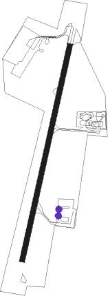
Airport layout - parking location Hanger


Parking locations

Nearby beacons

codeidentifierdistbearingfrequency
DUNETAJI SUBHASH CHANDRA BOSE IN NDB5.8115°385
CEAKOLKATA VOR/DME7.9142°112.50
JSRJASHORE VOR/DME50.362°113

Disclaimer

The information on this website is not for real aviation. Use this data with the X-Plane flight simulator only! Data taken with kind consent from X-Plane 12 source code and data files. Content is subject to change without notice.