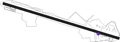
Hongkong - Shek Kong Airfield
Airport details
| Country | China |
| State | Hong Kong |
| Region | |
| Airspace | Hong Kong Ctr |
| Municipality | New Territories |
| Elevation | 47ft (14m) |
| Timezone | GMT +8 |
| Coordinates | 22.43724, 114.07839 |
| Magnetic var | |
| Type | land |
| Available since | X-Plane v10.40 |
| ICAO code | VHSK |
| IATA code | n/a |
| FAA code | n/a |
Communication
Nearby beacons
| code | identifier | dist | bearing | frequency |
|---|---|---|---|---|
| SC | STONECUTTERS (HONG KONG) NDB | 7.6 | 155° | 236 |
| SMT | SIU MO TO VOR/DME | 8 | 224° | 114.80 |
| RW | HONG KONG NDB | 9.1 | 134° | 377 |
| SHK | SHEKOU VOR/DME | 10.3 | 289° | 115.90 |
| LKC | LUNG KWU CHAU VOR/DME | 11.3 | 253° | 113.20 |
| SL | SHA LO WAN (HONG KONG) NDB | 12.9 | 230° | 268 |
| CH | CHAU DME | 13.3 | 193° | 112.30 |
| CC | HONG KONG CHEUNG NDB | 14.4 | 192° | 360 |
| GLN | GUANLAN VOR/DME | 16.4 | 351° | 112 |
| TD | TUNG LUNG VOR/DME | 16.4 | 131° | 116.10 |
| TH | TATHONG POINT VOR_DME VOR/DME | 16.6 | 133° | 115.50 |
| ZAO | JIUZHOU VOR/DME | 28.2 | 248° | 117.20 |
| NLG | NANLANG VOR/DME | 29.2 | 280° | 117.70 |
| MCU | MACAO VOR/DME | 32.2 | 238° | 116.40 |
| ZUH | LIANSHENGWEI VOR/DME | 36.3 | 251° | 116.70 |
| SHL | SHILONG VOR/DME | 41.2 | 341° | 115.70 |
| U | SANZAO NDB | 48.4 | 238° | 272 |
| UJ | GAOLAN NDB | 53.5 | 237° | 204 |
| CEN | CENCUN VOR/DME | 56.4 | 317° | 114.60 |
| POU | PINGZHOU VOR/DME | 60.4 | 303° | 114.10 |
| FO | GUANGZHOU NDB | 62.6 | 310° | 410 |
Disclaimer
The information on this website is not for real aviation. Use this data with the X-Plane flight simulator only! Data taken with kind consent from X-Plane 12 source code and data files. Content is subject to change without notice.
