Airports for X-Plane offers a convenient way to explore airports and their related communication information for the X-Plane flight simulator. It only uses data from the X-Plane flight simulator itself, and is therefore more reliable than the data that comes from real aviation websites. You can search for airports by using the ICAO code, or browse for airports per country and state. The information displayed is categorized by airport details, runway information, airport communication, approach frequencies (ILS and Glidepath details), details of nearby beacons, SIDs, STARs and approach procedures.

immigration landing area aircraft carrier train luggage consulate passenger flight public transport terminal airport check-in field arriving aerodromes airdrome stol airline city train station plane

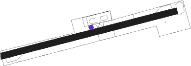
Diktel - Manamaya Rai Khanidanda

Airport details

CountryNepal
State[Other]
RegionVN
AirspaceKathmandu Ctr
MunicipalityDiktel
Elevation4432ft (1351m)
TimezoneGMT +5.75
Coordinates27.18122, 86.77184
Magnetic var
Typeland
Available sinceX-Plane v10.40
ICAO codeVNKG
IATA coden/a
FAA coden/a

Communication

No airport communication available for VNKG

Runway info

Runway 08 / 26
 length592m (1942ft)
 bearing81° / 261°
 width20m (66ft)
 surfaceasphalt

Airport layout - parking location Stand1


Parking locations

Nearby beacons

codeidentifierdistbearingfrequency
BRTBIRATNAGAR VOR/DME49.1146°114.10
JKPJANAKPUR NDB53.5241°287

Disclaimer

The information on this website is not for real aviation. Use this data with the X-Plane flight simulator only! Data taken with kind consent from X-Plane 12 source code and data files. Content is subject to change without notice.