Agatti
Airport details
| Country | India |
| State | Lakshadweep |
| Region | VO |
| Airspace | Chennai Ctr |
| Municipality | Agatti |
| Elevation | 14ft (4m) |
| Timezone | GMT +5.5 |
| Coordinates | 10.82880, 72.17891 |
| Magnetic var | |
| Type | land |
| Available since | X-Plane v10.30 |
| ICAO code | VOAT |
| IATA code | AGX |
| FAA code | n/a |
Communication
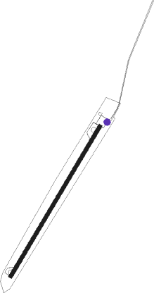
Runway info
| Runway 04 / 22 | ||
| length | 1295m (4249ft) | |
| bearing | 36° / 216° | |
| width | 30m (98ft) | |
| surface | asphalt | |
| displ threshold | 0m (0ft) / 190m (623ft) | |
| blast zone | 88m (289ft) / 0m (0ft) | |
Nearby beacons
| code | identifier | dist | bearing | frequency |
|---|---|---|---|---|
| AAT | DME | 0 | 139° | 115.90 |
| AT | AGATTI NDB | 0 | 348° | 360 |
Disclaimer
The information on this website is not for real aviation. Use this data with the X-Plane flight simulator only! Data taken with kind consent from X-Plane 12 source code and data files. Content is subject to change without notice.