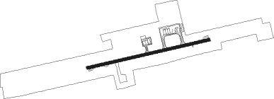
Tirupati
Airport details
| Country | India |
| State | Andhra Pradesh |
| Region | VO |
| Airspace | Chennai Ctr |
| Municipality | Renigunta |
| Elevation | 350ft (107m) |
| Timezone | GMT +5.5 |
| Coordinates | 13.63308, 79.54181 |
| Magnetic var | |
| Type | land |
| Available since | X-Plane v10.40 |
| ICAO code | VOTP |
| IATA code | TIR |
| FAA code | n/a |
Communication
| Tirupati Tower | 119.000 |
Approach frequencies
| ILS-cat-I | RW26 | 111.3 | 18.00mi |
| 3.2° GS | RW26 | 111.3 | 18.00mi |
Nearby beacons
| code | identifier | dist | bearing | frequency |
|---|---|---|---|---|
| TTP | TIRUPATI VOR/DME | 1.2 | 86° | 115.70 |
| MA | CHENNAI NDB | 51.2 | 142° | 228 |
| KKP | KANCHEEPURAM VOR/DME | 51.9 | 169° | 115.40 |
| CNI | CHENNAI VOR/DME | 52.5 | 135° | 114.90 |
| MMV | CHENNAI VOR/DME | 52.7 | 136° | 112.50 |
| CP | KADAPA NDB | 69.4 | 319° | 263 |
Instrument approach procedures
| runway | airway (heading) | route (dist, bearing) |
|---|---|---|
| RW08-Y | TP408 (105°) | TP408 TP412 (7mi, 171°) 4300ft |
| RW08-Y | TP409 (58°) | TP409 TP412 (7mi, 351°) 4300ft |
| RW08-Y | TP410 (82°) | TP410 TP412 (7mi, 82°) 4300ft |
| RNAV | TP412 4300ft TP417 (6mi, 82°) 3200ft VOTP (10mi, 81°) 402ft (4795mi, 260°) 900ft TP413 (4814mi, 80°) 5900ft TP413 (turn) 5900ft | |
| RW26-Y | TP401 (238°) | TP401 TP404 (7mi, 171°) 3500ft |
| RW26-Y | TP402 (286°) | TP402 TP404 (7mi, 351°) 3500ft |
| RW26-Y | TP403 (262°) | TP403 TP404 (7mi, 262°) 3500ft |
| RNAV | TP404 3500ft TP405 (7mi, 262°) 3000ft VOTP (9mi, 262°) 383ft (4795mi, 260°) 900ft TP406 (4794mi, 80°) TP407 (10mi, 81°) TP402 (11mi, 40°) 5900ft TP402 (turn) 5900ft |
Disclaimer
The information on this website is not for real aviation. Use this data with the X-Plane flight simulator only! Data taken with kind consent from X-Plane 12 source code and data files. Content is subject to change without notice.
