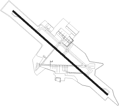
Thiruvananthapuram - Trivandrum Intl
Airport details
| Country | India |
| State | Kerala |
| Region | VO |
| Airspace | Chennai Ctr |
| Municipality | Thiruvananthapuram |
| Elevation | 16ft (5m) |
| Timezone | GMT +5.5 |
| Coordinates | 8.47944, 76.92000 |
| Magnetic var | |
| Type | land |
| Available since | X-Plane v10.40 |
| ICAO code | VOTV |
| IATA code | TRV |
| FAA code | n/a |
Communication
| Trivandrum Intl ATIS | 126.600 |
| Trivandrum Intl CON | 125.900 |
| Trivandrum Intl Tower | 118.100 |
| Trivandrum Intl Approach | 119.600 |
Approach frequencies
| ILS-cat-I | RW32 | 109.9 | 18.00mi |
| 3° GS | RW32 | 109.9 | 18.00mi |
Nearby beacons
| code | identifier | dist | bearing | frequency |
|---|---|---|---|---|
| TVM | THIRUVANANTHAPURAM VOR/DME | 0.3 | 137° | 115.10 |
Departure and arrival routes
| Transition altitude | 9000ft |
| SID end points | distance | outbound heading | |
|---|---|---|---|
| RW14 | |||
| GAKOT | 62mi | 3° | |
| BINUD | 50mi | 210° | |
| FORET | 50mi | 298° | |
| RW32 | |||
| RAMPU | 62mi | 3° | |
| KALAK | 192mi | 245° | |
| NUKET | 50mi | 313° | |
| STAR starting points | distance | inbound heading | |
|---|---|---|---|
| RW14 | |||
| DUMAT | 24.8 | 66° | |
| KAMEX | 24.6 | 97° | |
| MARUT | 29.6 | 123° | |
| KIDOL | 29.6 | 134° | |
| NERAL | 24.7 | 151° | |
| HIBUS | 18.1 | 156° | |
| RW32 | |||
| NOGAN | 25.3 | 17° | |
| SANOT | 11.0 | 98° | |
| DINKA | 21.8 | 162° | |
| MADUT | 26.8 | 258° | |
| BACOL | 35.4 | 299° | |
Holding patterns
| STAR name | hold at | type | turn | heading* | altitude | leg | speed limit |
|---|---|---|---|---|---|---|---|
| BACOL | BACOL | VHF | left | 113 (293)° | 11000ft - 12000ft | DME 10.0mi | 230 |
| DINKA | CIMLA | VHF | right | 16 (196)° | 8500ft - 13000ft | DME 10.0mi | 230 |
| DUMAT | TANIN | VHF | right | 222 (42)° | 5500ft - 8500ft | DME 10.0mi | 230 |
| HIBUS | PUTUR | VHF | left | 54 (234)° | 8500ft - 13000ft | DME 10.0mi | 230 |
| MADUT | GROTI | VHF | left | 33 (213)° | 8500ft - 13000ft | DME 10.0mi | 230 |
| METOP | BADUL | VHF | left | 111 (291)° | 11000ft - 12000ft | DME 10.0mi | 230 |
| NERAL | NERAL | VHF | right | 348 (168)° | 5500ft - 8500ft | DME 10.0mi | 230 |
| NOGAN | PARIT | VHF | right | 224 (44)° | 5500ft - 8500ft | DME 10.0mi | 230 |
| SANOT | CIMLA | VHF | right | 16 (196)° | 8500ft - 13000ft | DME 10.0mi | 230 |
| *) magnetic outbound (inbound) holding course | |||||||
Disclaimer
The information on this website is not for real aviation. Use this data with the X-Plane flight simulator only! Data taken with kind consent from X-Plane 12 source code and data files. Content is subject to change without notice.
