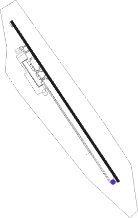
Paro - Paro Intl
Airport details
| Country | Bhutan |
| State | Paro District |
| Region | VQ |
| Airspace | Guwahati Ctr |
| Municipality | Paro |
| Elevation | 7362ft (2244m) |
| Timezone | GMT +6 |
| Coordinates | 27.40910, 89.41991 |
| Magnetic var | |
| Type | land |
| Available since | X-Plane v10.40 |
| ICAO code | VQPR |
| IATA code | PBH |
| FAA code | n/a |
Communication
| Paro Intl AWOS | 133.425 |
| Paro Intl Paro Tower | 120.300 |
| Paro Intl DPR | 120.300 |
Nearby beacons
| code | identifier | dist | bearing | frequency |
|---|---|---|---|---|
| PR | PARO NDB | 0.6 | 153° | 410 |
| PRO | PARO VOR/DME | 7.9 | 142° | 108.40 |
| PKG | PAKYONG VOR/DME | 45.6 | 258° | 117.80 |
Departure and arrival routes
| Transition altitude | 18000ft |
| STAR starting points | distance | inbound heading | |
|---|---|---|---|
| ALL | |||
| SUBSU1 | 39.2 | 52° | |
| TASHI1 | 33.6 | 269° | |
| BOGO1A, BOGO1B | 44.1 | 334° | |
Instrument approach procedures
| runway | airway (heading) | route (dist, bearing) |
|---|---|---|
| RW15-Z | GTSHO (275°) | GTSHO 17500ft PR854 (2mi, 274°) PR852 (6mi, 254°) 16100ft PR850 (3mi, 233°) 15300ft PR820 (7mi, 233°) PR724 (4mi, 260°) PR826 (2mi, 285°) PR728 (2mi, 285°) PR730 (5mi, 325°) PR799 (3mi, 347°) 13800ft PR818 (3mi, 323°) |
| RW15-Z | PR777 (340°) | PR777 16000ft PR848 (2mi, 353°) PR830 (4mi, 323°) PR828 (4mi, 296°) PR826 (turn) PR728 (2mi, 285°) PR730 (5mi, 325°) PR799 (3mi, 347°) 13800ft PR818 (3mi, 323°) |
| RW15-Z | PR888 (42°) | PR888 17000ft PR744 (2mi, 64°) PR842 (6mi, 39°) 15200ft PR730 (4mi, 11°) PR799 (3mi, 347°) 13800ft PR818 (3mi, 323°) |
| RNAV | PR818 PR816 (4mi, 14°) 13800ft PR814 (1mi, 73°) PR812 (3mi, 114°) PR810 (2mi, 124°) PR808 (3mi, 130°) 10200ft PR706 (3mi, 159°) PR710 (3mi, 118°) PR712 (4mi, 141°) PR714 (1mi, 211°) PR746 (3mi, 192°) PR848 (4mi, 173°) PR777 (2mi, 173°) PR794 (5mi, 138°) PR796 (5mi, 259°) PR798 (5mi, 23°) PR777 (turn) 16000ft | |
| RW33-X | GTSHO (275°) | GTSHO 17500ft PR754 (7mi, 274°) 15700ft PR752 (13mi, 273°) PR750 (6mi, 247°) 15400ft PR730 (3mi, 205°) 13800ft PR728 (5mi, 145°) PR724 (4mi, 105°) 13100ft PR722 (2mi, 91°) 12600ft PR714 (4mi, 55°) PR712 (1mi, 31°) 11800ft |
| RW33-X | PR777 (340°) | PR777 16000ft PR746 (6mi, 353°) PR714 (3mi, 12°) PR712 (1mi, 31°) 11800ft |
| RW33-X | PR888 (42°) | PR888 17000ft PR744 (2mi, 64°) PR742 (3mi, 75°) PR740 (6mi, 86°) 14400ft PR738 (2mi, 86°) 13600ft PR736 (turn) 13100ft PR734 (4mi, 59°) 12400ft PR732 (turn) PR714 (1mi, 31°) PR712 (1mi, 31°) 11800ft |
| RNAV | PR712 11800ft PR710 (4mi, 321°) PR708 (2mi, 278°) 9850ft PR706 (2mi, 316°) PR704 (2mi, 339°) PR808 (1mi, 339°) PR810 (3mi, 310°) PR812 (2mi, 304°) PR818 (6mi, 241°) PR799 (3mi, 143°) PR730 (3mi, 167°) PR728 (5mi, 145°) PR826 (2mi, 105°) PR828 (turn) PR830 (4mi, 116°) PR848 (4mi, 143°) PR777 (2mi, 173°) 16000ft | |
| RW33-Y | GTSHO (275°) | GTSHO 17500ft PR754 (7mi, 274°) 15700ft PR752 (13mi, 273°) PR750 (6mi, 247°) 15400ft PR730 (3mi, 205°) 13800ft PR728 (5mi, 145°) PR724 (4mi, 105°) 13100ft PR722 (2mi, 91°) 12600ft PR714 (4mi, 55°) PR712 (1mi, 31°) 11800ft |
| RW33-Y | PR777 (340°) | PR777 16000ft PR746 (6mi, 353°) PR714 (3mi, 12°) PR712 (1mi, 31°) 11800ft |
| RW33-Y | PR888 (42°) | PR888 17000ft PR744 (2mi, 64°) PR742 (3mi, 75°) PR740 (6mi, 86°) 14400ft PR738 (2mi, 86°) 13600ft PR736 (turn) 13100ft PR734 (4mi, 59°) 12400ft PR732 (turn) PR714 (1mi, 31°) PR712 (1mi, 31°) 11800ft |
| RNAV | PR712 11800ft PR710 (4mi, 321°) PR708 (2mi, 278°) 9850ft PR706 (2mi, 316°) PR704 (2mi, 339°) PR790 (6mi, 74°) PR792 (1mi, 161°) PR712 (7mi, 186°) PR714 (1mi, 211°) PR746 (3mi, 192°) PR777 (6mi, 173°) PR794 (5mi, 138°) PR796 (5mi, 259°) PR798 (5mi, 23°) PR777 (turn) 16000ft |
Holding patterns
| STAR name | hold at | type | turn | heading* | altitude | leg | speed limit |
|---|---|---|---|---|---|---|---|
| BOGO1A | PR777 | VHF | right | 174 (354)° | 16000ft - 16000ft | 1.5min timed | 185 |
| SUBSU1 | PR888 | VHF | left | 241 (61)° | 17000ft - 19000ft | 1.5min timed | 185 |
| TASHI1 | GTSHO | VHF | left | 94 (274)° | 17500ft - 19000ft | 1.5min timed | 230 |
| *) magnetic outbound (inbound) holding course | |||||||
Disclaimer
The information on this website is not for real aviation. Use this data with the X-Plane flight simulator only! Data taken with kind consent from X-Plane 12 source code and data files. Content is subject to change without notice.