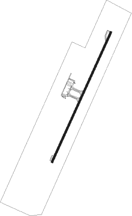
Chiang Rai - Chiang Rai Intl
Airport details
| Country | Thailand |
| State | Chiang Rai Province |
| Region | VT |
| Airspace | Bangkok Ctr |
| Municipality | Ban Du |
| Elevation | 1276ft (389m) |
| Timezone | GMT +7 |
| Coordinates | 19.95222, 99.88306 |
| Magnetic var | |
| Type | land |
| Available since | X-Plane v10.40 |
| ICAO code | VTCT |
| IATA code | CEI |
| FAA code | n/a |
Communication
| Chiang Rai Intl Tower | 118.400 |
| Chiang Rai Intl Approach | 120.050 |
Approach frequencies
| ILS-cat-I | RW03 | 109.5 | 18.00mi |
| 3° GS | RW03 | 109.5 | 18.00mi |
Nearby Points of Interest:
Wat Phra That Doi Ku Kaeo
-Wat Chedi Chet Yot
-Wat Saen Mueang Ma
Nearby beacons
| code | identifier | dist | bearing | frequency |
|---|---|---|---|---|
| CTR | CHIANG RAI VOR/DME | 0.2 | 176° | 116.50 |
| CT | CHIANG RAI NDB | 0.4 | 0° | 277 |
| TCL | TACHILEIK VOR/DME | 32 | 6° | 114.50 |
| TL | TACHILEIK NDB | 32 | 6° | 375 |
| MS | MONG-HSAT NDB | 48.9 | 312° | 312 |
Departure and arrival routes
| Transition altitude | 11000ft |
| Transition level | 13000ft |
| SID end points | distance | outbound heading | |
|---|---|---|---|
| RW03 | |||
| PONU1A | 36mi | 54° | |
| NAN1A | 85mi | 141° | |
| DUBE1A | 30mi | 142° | |
| BENV1A | 30mi | 171° | |
| PAE1A | 110mi | 171° | |
| CMA1A | 88mi | 218° | |
| NUMD1A | 30mi | 218° | |
| RW21 | |||
| PONU1B | 36mi | 54° | |
| NAN1B | 85mi | 141° | |
| DUBE1B | 30mi | 142° | |
| PAE1B | 110mi | 171° | |
| BENV1B | 30mi | 171° | |
| CMA1B | 88mi | 218° | |
| NUMD1B | 30mi | 218° | |
Instrument approach procedures
| runway | airway (heading) | route (dist, bearing) |
|---|---|---|
| RW03 | BENVI (351°) | BENVI 10000ft REDIP (20mi, 319°) 6000ft |
| RW03 | DUBEN (322°) | DUBEN 10000ft MIKAV (21mi, 286°) 7000ft REDIP (7mi, 298°) 6000ft |
| RW03 | NUMDO (38°) | NUMDO 10000ft REDIP (14mi, 47°) 6000ft |
| RW03 | PONUK (234°) | PONUK 11000ft EMTOD (26mi, 227°) 8000ft CT035 (10mi, 210°) 8000ft MIKAV (15mi, 210°) 7000ft REDIP (7mi, 298°) 6000ft |
| RNAV | REDIP 6000ft CT034 (9mi, 30°) 3600ft CT033 (7mi, 30°) 1330ft (5962mi, 259°) 4500ft EMTOD (5972mi, 79°) 8000ft EMTOD (turn) 8000ft | |
| RW21 | BENVI (351°) | BENVI 10000ft ADNES (24mi, 0°) 10000ft TEPED (16mi, 30°) 6000ft LAREV (7mi, 298°) 4500ft |
| RW21 | DUBEN (322°) | DUBEN 10000ft ADNES (23mi, 322°) 10000ft TEPED (16mi, 30°) 6000ft LAREV (7mi, 298°) 4500ft |
| RW21 | NUMDO (38°) | NUMDO 10000ft ADNES (29mi, 53°) 10000ft TEPED (16mi, 30°) 6000ft LAREV (7mi, 298°) 4500ft |
| RW21 | PONUK (234°) | PONUK 10000ft TEPED (21mi, 231°) 6000ft LAREV (7mi, 298°) 4500ft |
| RNAV | LAREV 4500ft CT216 (6mi, 210°) 3200ft CT215 (3mi, 210°) 2280ft CT214 (3mi, 210°) 1325ft (5963mi, 259°) 3200ft TEPED (5975mi, 79°) 6000ft TEPED (turn) 6000ft |
Disclaimer
The information on this website is not for real aviation. Use this data with the X-Plane flight simulator only! Data taken with kind consent from X-Plane 12 source code and data files. Content is subject to change without notice.
