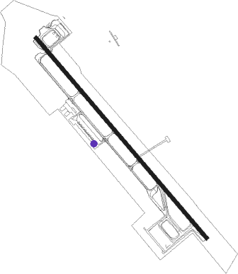
Phitsanulok
Airport details
| Country | Thailand |
| State | Phitsanulok Province |
| Region | VT |
| Airspace | Bangkok Ctr |
| Municipality | Phitsanulok |
| Elevation | 145ft (44m) |
| Timezone | GMT +7 |
| Coordinates | 16.78293, 100.27912 |
| Magnetic var | |
| Type | land |
| Available since | X-Plane v10.40 |
| ICAO code | VTPP |
| IATA code | PHS |
| FAA code | n/a |
Communication
| Phitsanulok Ground Control | 121.900 |
| Phitsanulok Tower | 118.900 |
| Phitsanulok Approach | 120.700 |
Approach frequencies
| ILS-cat-I | RW32 | 110.1 | 18.00mi |
| 3° GS | RW32 | 110.1 | 18.00mi |
Nearby Points of Interest:
Wat Pho Prathap Chang
-Wat Chedi Si Hong
-Wat Traphang Thong
-Historic Town of Sukhothai and Associated Historic Towns
-San Ta Pha Daeng
Nearby beacons
| code | identifier | dist | bearing | frequency |
|---|---|---|---|---|
| PL | PHITSANULOK NDB | 0.8 | 345° | 263 |
| PSL | PHITSANULOK VOR/DME | 1 | 136° | 114.10 |
| THS | SUKHOTHAI NDB | 37.7 | 315° | 292 |
| THS | DME-ILS | 37.9 | 315° | 110.30 |
| PC | PHETCHABUN NDB | 52.9 | 98° | 283 |
| PH | PHETCHABUN NDB | 52.9 | 98° | 283 |
| PCB | PHETCHABUN VOR/DME | 53.1 | 97° | 115.40 |
Departure and arrival routes
| Transition altitude | 11000ft |
| Transition level | 13000ft |
| SID end points | distance | outbound heading | |
|---|---|---|---|
| RW14 | |||
| PEBL1A | 31mi | 178° | |
| PIBI1A | 29mi | 326° | |
| RW32 | |||
| GOST1B | 30mi | 11° | |
| REME1B | 30mi | 66° | |
| GOKO1B | 31mi | 97° | |
| PEBL1B | 31mi | 178° | |
| PIBI1B | 29mi | 326° | |
| POLO1B | 29mi | 333° | |
| NIRO1B | 29mi | 356° | |
Instrument approach procedures
| runway | airway (heading) | route (dist, bearing) |
|---|---|---|
| RW14 | ENLAX (177°) | ENLAX 5000ft OMBAR (9mi, 225°) 3200ft |
| RW14 | OMBAR (143°) | OMBAR 3200ft |
| RW14 | PEBLI (358°) | PEBLI 7000ft NITAL (15mi, 318°) 7000ft KALUX (17mi, 340°) 5000ft NIVUS (6mi, 342°) 5000ft OSPAL (5mi, 41°) 5000ft OMBAR (7mi, 55°) 3200ft |
| RW14 | VIRUM (147°) | VIRUM 5000ft OMBAR (10mi, 151°) 3200ft |
| RNAV | OMBAR 3200ft PULUM (5mi, 143°) 2100ft PP140 (6mi, 143°) 195ft (5995mi, 260°) 1600ft OMBAR (5988mi, 80°) 3200ft OMBAR (turn) 3200ft | |
| RW32 | KAMAB (278°) | KAMAB 5000ft PUGAN (14mi, 235°) 3200ft |
| RW32 | PEBLI (358°) | PEBLI 7000ft TAXIN (13mi, 360°) 5000ft PUGAN (10mi, 50°) 3200ft |
| RW32 | PUGAN (323°) | PUGAN 3200ft |
| RNAV | PUGAN 3200ft POSIL (7mi, 323°) 2100ft PP320 (6mi, 323°) 195ft (5996mi, 261°) 1600ft PUGAN (6005mi, 81°) 3200ft PUGAN (turn) 3200ft |
Disclaimer
The information on this website is not for real aviation. Use this data with the X-Plane flight simulator only! Data taken with kind consent from X-Plane 12 source code and data files. Content is subject to change without notice.