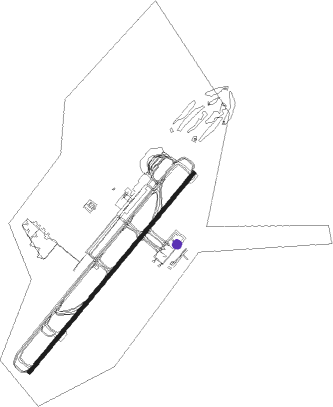
Surat Thani
Airport details
| Country | Thailand |
| State | Surat Thani Province |
| Region | VT |
| Airspace | Bangkok Ctr |
| Municipality | Wat Pradu |
| Elevation | 20ft (6m) |
| Timezone | GMT +7 |
| Coordinates | 9.13281, 99.14066 |
| Magnetic var | |
| Type | land |
| Available since | X-Plane v10.40 |
| ICAO code | VTSB |
| IATA code | URT |
| FAA code | n/a |
Communication
| Surat Thani ATIS | 125.950 |
| Surat Thani Ground Control | 121.900 |
| Surat Thani Tower | 122.700 |
| Surat Thani Approach | 129.600 |
Approach frequencies
| ILS-cat-I | RW22 | 109.5 | 18.00mi |
| 3° GS | RW22 | 109.5 | 18.00mi |
Nearby Points of Interest:
Wat Phunphin Tai
-Wat Khao Si Wichai
-Wat Khao Phra Anon
-Wat Kaeo
-Wat Khao Phra Nim
-Laem Son National Park
Nearby beacons
| code | identifier | dist | bearing | frequency |
|---|---|---|---|---|
| SRT | SURAT THANI TACAN | 0.3 | 254° | 113.20 |
| STN | SURAT THANI VOR/DME | 0.4 | 241° | 110.60 |
| RN | RANONG NDB | 50.8 | 320° | 375 |
| RAN | RANONG VOR/DME | 50.9 | 319° | 113.40 |
| NKS | NAKHON SI THAMMARAT VOR/DME | 59.5 | 126° | 117.40 |
| SMU | SAMUI VOR/DME | 59.9 | 66° | 117.60 |
| SM | SAMUI (SURAT THANI) NDB | 60 | 65° | 316 |
| KT | KAWTHOUNG NDB | 65.5 | 327° | 290 |
Departure and arrival routes
| Transition altitude | 11000ft |
| Transition level | 13000ft |
| SID end points | distance | outbound heading | |
|---|---|---|---|
| RW04 | |||
| NIXE1D | 25mi | 46° | |
| ADLA1D | 25mi | 66° | |
| SEGR1D | 25mi | 127° | |
| EMVE1D | 27mi | 151° | |
| IDNA1D | 25mi | 164° | |
| TAVA1D | 25mi | 189° | |
| LAMU1D | 25mi | 220° | |
| TOGI1D | 25mi | 319° | |
| RW22 | |||
| NIXE1X, NIXE1C | 25mi | 46° | |
| ADLA1C | 25mi | 66° | |
| SEGR1C | 25mi | 127° | |
| EMVE1C | 27mi | 151° | |
| IDNA1C | 25mi | 164° | |
| TAVA1C | 25mi | 189° | |
| LAMU1C | 25mi | 220° | |
| TOGI1C | 25mi | 319° | |
| STAR starting points | distance | inbound heading | |
|---|---|---|---|
| RW04 | |||
| TAVA1B | 25.3 | 9° | |
| LAMU1B | 25.4 | 40° | |
| TOGI1B | 25.1 | 139° | |
| IKER1B | 24.8 | 197° | |
| ADLA1B | 24.6 | 246° | |
| SEGR1B | 24.8 | 307° | |
| EMVE1B | 26.6 | 331° | |
| IDNA1B | 25.2 | 344° | |
| RW22 | |||
| TAVA1A | 25.3 | 9° | |
| LAMU1A | 25.4 | 40° | |
| TOGI1A | 25.1 | 139° | |
| IKER1A | 24.8 | 197° | |
| ADLA1A | 24.6 | 246° | |
| SEGR1A | 24.8 | 307° | |
| EMVE1A | 26.6 | 331° | |
| IDNA1A | 25.2 | 344° | |
Instrument approach procedures
| runway | airway (heading) | route (dist, bearing) |
|---|---|---|
| RW04 | EMTOB (41°) | EMTOB 5000ft METIN (7mi, 33°) 3200ft |
| RW04 | METIN (45°) | METIN 3200ft |
| RW04 | MULRO (24°) | MULRO 5000ft METIN (7mi, 341°) 3200ft |
| RW04 | VARSA (79°) | VARSA 5100ft METIN (9mi, 134°) 3200ft |
| RW04 | VELRA (17°) | VELRA 5000ft METIN (7mi, 314°) 3200ft |
| RNAV | METIN 3200ft SB404 (2mi, 44°) 2700ft SB403 (4mi, 44°) 2200ft SB402 (4mi, 44°) 930ft SB401 (3mi, 44°) 70ft (5946mi, 265°) 1200ft URBAT (5955mi, 85°) VELRA (18mi, 224°) METIN (7mi, 314°) 3200ft METIN (turn) 3200ft | |
| RW22 | BAVOR (238°) | BAVOR 5000ft GULNA (7mi, 266°) 3000ft |
| RW22 | BEVLA (195°) | BEVLA 5000ft GULNA (7mi, 134°) 3000ft |
| RW22 | ELNON (253°) | ELNON 5000ft GULNA (7mi, 314°) 3000ft |
| RW22 | GULNA (223°) | GULNA 3000ft |
| RW22 | GUPES (206°) | GUPES 5000ft GULNA (7mi, 174°) 3000ft |
| RNAV | GULNA 3000ft SB202 (5mi, 224°) 2200ft SB201 (7mi, 224°) 68ft (5947mi, 265°) 1200ft GOVDA (5949mi, 85°) ELNON (17mi, 44°) GULNA (7mi, 314°) 3000ft GULNA (turn) 3000ft |
Holding patterns
| STAR name | hold at | type | turn | heading* | altitude | leg | speed limit |
|---|---|---|---|---|---|---|---|
| ADLA1A | GULNA | VHF | right | 45 (225)° | > 3000ft | 1.0min timed | 230 |
| ADLA1B | METIN | VHF | right | 225 (45)° | > 3200ft | 1.0min timed | 210 |
| EMVE1A | GULNA | VHF | right | 45 (225)° | > 3000ft | 1.0min timed | 230 |
| EMVE1B | METIN | VHF | right | 225 (45)° | > 3200ft | 1.0min timed | 210 |
| IDNA1A | GULNA | VHF | right | 45 (225)° | > 3000ft | 1.0min timed | 230 |
| IDNA1B | METIN | VHF | right | 225 (45)° | > 3200ft | 1.0min timed | 210 |
| IKER1A | GULNA | VHF | right | 45 (225)° | > 3000ft | 1.0min timed | 230 |
| IKER1A | IKERA | VHF | right | 18 (198)° | > 7000ft | 1.0min timed | 230 |
| IKER1B | METIN | VHF | right | 225 (45)° | > 3200ft | 1.0min timed | 210 |
| LAMU1A | GULNA | VHF | right | 45 (225)° | > 3000ft | 1.0min timed | 230 |
| LAMU1B | METIN | VHF | right | 225 (45)° | > 3200ft | 1.0min timed | 210 |
| SEGR1A | GULNA | VHF | right | 45 (225)° | > 3000ft | 1.0min timed | 230 |
| SEGR1B | METIN | VHF | right | 225 (45)° | > 3200ft | 1.0min timed | 210 |
| TAVA1A | GULNA | VHF | right | 45 (225)° | > 3000ft | 1.0min timed | 230 |
| TAVA1B | METIN | VHF | right | 225 (45)° | > 3200ft | 1.0min timed | 210 |
| TOGI1A | GULNA | VHF | right | 45 (225)° | > 3000ft | 1.0min timed | 230 |
| TOGI1B | METIN | VHF | right | 225 (45)° | > 3200ft | 1.0min timed | 210 |
| *) magnetic outbound (inbound) holding course | |||||||
Disclaimer
The information on this website is not for real aviation. Use this data with the X-Plane flight simulator only! Data taken with kind consent from X-Plane 12 source code and data files. Content is subject to change without notice.