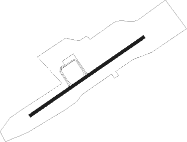
Chumphon
Airport details
| Country | Thailand |
| State | Chumphon Province |
| Region | VT |
| Airspace | Bangkok Ctr |
| Municipality | Chum Kho |
| Elevation | 18ft (5m) |
| Timezone | GMT +7 |
| Coordinates | 10.71428, 99.36033 |
| Magnetic var | |
| Type | land |
| Available since | X-Plane v10.40 |
| ICAO code | VTSE |
| IATA code | CJM |
| FAA code | n/a |
Communication
| Chumphon Tower | 122.150 |
| Chumphon Approach | 119.750 |
| Chumphon Approach | 129.600 |
Approach frequencies
| ILS-cat-I | RW24 | 109.9 | 18.00mi |
| 3° GS | RW24 | 109.9 | 18.00mi |
Nearby beacons
| code | identifier | dist | bearing | frequency |
|---|---|---|---|---|
| CPN | CHUMPHON VOR/DME | 0.3 | 121° | 110 |
| CP | CHUMPHON NDB | 0.4 | 59° | 279 |
| KT | KAWTHOUNG NDB | 62.7 | 231° | 290 |
| RN | RANONG NDB | 72 | 220° | 375 |
| RAN | RANONG VOR/DME | 72.5 | 220° | 113.40 |
Instrument approach procedures
| runway | airway (heading) | route (dist, bearing) |
|---|---|---|
| RW06 | LERBU (224°) | LERBU 8000ft SE065 (19mi, 242°) 8000ft SE064 (15mi, 240°) 5000ft NUDSO (7mi, 150°) 3200ft |
| RW06 | MAGMI (39°) | VEMLO 7000ft MAGMI (6mi, 40°) 5000ft NUDSO (7mi, 354°) 3200ft |
| RNAV | NUDSO 3200ft SE063 (7mi, 60°) 1900ft SE062 (2mi, 60°) 1200ft SE061 (4mi, 60°) 68ft (5957mi, 264°) 1500ft NUDSO (5946mi, 84°) 3200ft NUDSO (turn) 3200ft | |
| RW24 | ANDET (223°) | ANDET 7000ft LERBU (7mi, 223°) 5000ft IGAKO (9mi, 195°) 3000ft |
| RW24 | MAGMI (39°) | MAGMI 8000ft SE244 (16mi, 63°) 8000ft SE243 (15mi, 60°) 5000ft IGAKO (7mi, 330°) 3000ft |
| RNAV | IGAKO 3000ft SE242 (8mi, 240°) 1900ft SE241 (6mi, 240°) 68ft (5958mi, 264°) 1500ft IGAKO (5970mi, 84°) 3000ft IGAKO (turn) 3000ft |
Disclaimer
The information on this website is not for real aviation. Use this data with the X-Plane flight simulator only! Data taken with kind consent from X-Plane 12 source code and data files. Content is subject to change without notice.
