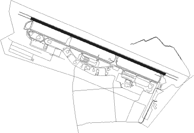
Udon Thani - Udon Thani Intl
Airport details
| Country | Thailand |
| State | Udon Thani Province |
| Region | VT |
| Airspace | Bangkok Ctr |
| Municipality | Udon Thani |
| Elevation | 579ft (176m) |
| Timezone | GMT +7 |
| Coordinates | 17.38644, 102.78825 |
| Magnetic var | |
| Type | land |
| Available since | X-Plane v10.40 |
| ICAO code | VTUD |
| IATA code | UTH |
| FAA code | n/a |
Communication
| Udon Thani Intl Ground Control | 121.900 |
| Udon Thani Intl Tower | 122.500 |
| Udon Thani Intl Approach | 126.200 |
Approach frequencies
| ILS-cat-I | RW30 | 110.1 | 18.00mi |
| 3° GS | RW30 | 110.1 | 18.00mi |
Nearby Points of Interest:
Wat Si Khun Mueang
-Phu Phra Bat Historical Park
Nearby beacons
| code | identifier | dist | bearing | frequency |
|---|---|---|---|---|
| UDN | UDON THANI VOR/DME | 0.7 | 262° | 114.30 |
| UD | UDON THANI NDB | 1 | 274° | 236 |
| VTN | VIENTIANE VOR/DME | 40 | 338° | 117.50 |
| VTG | THANGONE NDB | 45.8 | 348° | 405 |
| KKN | KHON KAEN VOR/DME | 54.9 | 180° | 114.90 |
| KN | KHON KAEN NDB | 55.5 | 180° | 393 |
| CMP | CHUM PHAE VOR/DME | 64.3 | 227° | 112.90 |
Departure and arrival routes
| Transition altitude | 11000ft |
| Transition level | 13000ft |
| SID end points | distance | outbound heading | |
|---|---|---|---|
| RW12 | |||
| GULN1B | 29mi | 97° | |
| POVE1B | 30mi | 143° | |
| ANPU1B | 25mi | 181° | |
| TERC1B | 31mi | 207° | |
| SURG1B | 31mi | 228° | |
| ESGI1B | 31mi | 273° | |
| ELNE1B | 25mi | 338° | |
| RW30 | |||
| GULN1D | 29mi | 97° | |
| POVE1D | 30mi | 143° | |
| ANPU1D | 25mi | 181° | |
| TERC1D | 31mi | 207° | |
| SURG1D | 31mi | 228° | |
| ESGI1D | 31mi | 273° | |
| ELNE1D | 25mi | 338° | |
| STAR starting points | distance | inbound heading | |
|---|---|---|---|
| RW12 | |||
| ANPU1A | 25.2 | 1° | |
| SURG1A | 30.6 | 48° | |
| ESGI1A | 30.6 | 93° | |
| ELNE1A | 24.9 | 158° | |
| MUGN1A | 29.7 | 201° | |
| GULN1A | 29.2 | 277° | |
| POVE1A | 29.7 | 323° | |
| RW30 | |||
| ANPU1C | 25.2 | 1° | |
| SURG1C | 30.6 | 48° | |
| ESGI1C | 30.6 | 93° | |
| ELNE1C | 24.9 | 158° | |
| MUGN1C | 29.7 | 201° | |
| GULN1C | 29.2 | 277° | |
| POVE1C | 29.7 | 323° | |
Instrument approach procedures
| runway | airway (heading) | route (dist, bearing) |
|---|---|---|
| RW12 | LEBOG (116°) | LEBOG 5000ft TELUG (5mi, 116°) 3500ft |
| RW12 | RIRMI (90°) | RIRMI 5000ft TELUG (7mi, 28°) 3500ft |
| RW12 | RUGBU (143°) | RUGBU 5000ft TELUG (7mi, 208°) 3500ft |
| RNAV | TELUG 3500ft UD124 (7mi, 116°) 2500ft UD123 (6mi, 116°) 629ft (6137mi, 260°) 1500ft ENGEB (6138mi, 80°) RUGBU (11mi, 296°) 5000ft TELUG (7mi, 208°) 3500ft TELUG (turn) 3500ft | |
| RW30 | ALDES (268°) | ALDES 5000ft MUNUR (7mi, 208°) 3500ft |
| RW30 | LATUR (296°) | LATUR 5000ft MUNUR (5mi, 296°) 3500ft |
| RW30 | OTLOR (325°) | OTLOR 5000ft MUNUR (7mi, 28°) 3500ft |
| RNAV | MUNUR 3500ft UD305 (6mi, 296°) 2500ft UD304 (6mi, 296°) 629ft (6138mi, 260°) 1500ft OSPEK (6142mi, 80°) ALDES (11mi, 116°) 5000ft MUNUR (7mi, 208°) 3500ft MUNUR (turn) 3500ft |
Holding patterns
| STAR name | hold at | type | turn | heading* | altitude | leg | speed limit |
|---|---|---|---|---|---|---|---|
| ANPU1A | TELUG | VHF | right | 298 (118)° | > 3500ft | 1.0min timed | 230 |
| ANPU1C | MUNUR | VHF | right | 118 (298)° | > 3500ft | 1.0min timed | 230 |
| ELNE1A | TELUG | VHF | right | 298 (118)° | > 3500ft | 1.0min timed | 230 |
| ELNE1C | MUNUR | VHF | right | 118 (298)° | > 3500ft | 1.0min timed | 230 |
| ESGI1A | TELUG | VHF | right | 298 (118)° | > 3500ft | 1.0min timed | 230 |
| ESGI1C | MUNUR | VHF | right | 118 (298)° | > 3500ft | 1.0min timed | 230 |
| GULN1A | TELUG | VHF | right | 298 (118)° | > 3500ft | 1.0min timed | 230 |
| GULN1C | MUNUR | VHF | right | 118 (298)° | > 3500ft | 1.0min timed | 230 |
| MUGN1A | TELUG | VHF | right | 298 (118)° | > 3500ft | 1.0min timed | 230 |
| MUGN1C | MUNUR | VHF | right | 118 (298)° | > 3500ft | 1.0min timed | 230 |
| POVE1A | TELUG | VHF | right | 298 (118)° | > 3500ft | 1.0min timed | 230 |
| POVE1C | MUNUR | VHF | right | 118 (298)° | > 3500ft | 1.0min timed | 230 |
| SURG1A | TELUG | VHF | right | 298 (118)° | > 3500ft | 1.0min timed | 230 |
| SURG1C | MUNUR | VHF | right | 118 (298)° | > 3500ft | 1.0min timed | 230 |
| *) magnetic outbound (inbound) holding course | |||||||
Disclaimer
The information on this website is not for real aviation. Use this data with the X-Plane flight simulator only! Data taken with kind consent from X-Plane 12 source code and data files. Content is subject to change without notice.