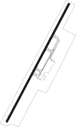
Khon Kaen
Airport details
| Country | Thailand |
| State | Khon Kaen Province |
| Region | VT |
| Airspace | Bangkok Ctr |
| Municipality | Ban Pet |
| Elevation | 668ft (204m) |
| Timezone | GMT +7 |
| Coordinates | 16.46455, 102.78227 |
| Magnetic var | |
| Type | land |
| Available since | X-Plane v10.40 |
| ICAO code | VTUK |
| IATA code | KKC |
| FAA code | n/a |
Communication
| Khon Kaen Tower | 122.250 |
| Khon Kaen Approach | 123.400 |
Nearby beacons
| code | identifier | dist | bearing | frequency |
|---|---|---|---|---|
| KN | KHON KAEN NDB | 0.1 | 138° | 393 |
| KKN | KHON KAEN VOR/DME | 0.4 | 42° | 114.90 |
| CMP | CHUM PHAE VOR/DME | 46.8 | 282° | 112.90 |
| UDN | UDON THANI VOR/DME | 55.2 | 360° | 114.30 |
| UD | UDON THANI NDB | 55.4 | 359° | 236 |
| ROT | ROI ET VOR/DME | 60.7 | 109° | 111.20 |
| RE | ROI ET NDB | 61.2 | 110° | 319 |
Departure and arrival routes
| Transition altitude | 11000ft |
| Transition level | 13000ft |
| SID end points | distance | outbound heading | |
|---|---|---|---|
| RW03 | |||
| AKRE1A | 24mi | 61° | |
| SEDN1C | 31mi | 109° | |
| EMRU1A | 30mi | 202° | |
| NEMT1A | 30mi | 216° | |
| ONUV1A | 20mi | 283° | |
| ALGI1A | 25mi | 360° | |
| RW21 | |||
| AKRE1B | 24mi | 61° | |
| SEDN1D | 31mi | 109° | |
| EMRU1B | 30mi | 202° | |
| NEMT1B | 30mi | 216° | |
| ONUV1B | 20mi | 283° | |
| ALGI1B | 25mi | 360° | |
Instrument approach procedures
| runway | airway (heading) | route (dist, bearing) |
|---|---|---|
| RW03 | AKRET (241°) | AKRET 10000ft URBOM (11mi, 221°) 10000ft IRNIP (10mi, 221°) 9000ft BILIL (14mi, 221°) 5000ft KASRA (7mi, 302°) 3400ft |
| RW03 | ALGIT (180°) | ALGIT 10000ft MOLVU (10mi, 202°) 10000ft MABDI (12mi, 202°) 9000ft SUBNU (12mi, 202°) 5000ft KASRA (7mi, 122°) 3400ft |
| RW03 | EMRUT (22°) | EMRUT 8000ft KASRA (18mi, 14°) 3400ft |
| RW03 | ONUVI (103°) | ONUVI 9000ft OMBEV (5mi, 149°) 7000ft SUBNU (8mi, 149°) 5000ft KASRA (7mi, 122°) 3400ft |
| RW03 | SEDNO (289°) | SEDNO 7000ft KASDU (15mi, 263°) 5000ft BILIL (15mi, 263°) 5000ft KASRA (7mi, 302°) 3400ft |
| RNAV | KASRA 3400ft BOPLA (7mi, 34°) 2200ft VIDOL (5mi, 34°) 651ft (6141mi, 261°) 1500ft KASRA (6135mi, 81°) 3400ft KASRA (turn) 3400ft | |
| RW21 | AKRET (241°) | AKRET 7000ft ELGEV (14mi, 266°) 3400ft |
| RW21 | ALGIT (180°) | ALGIT 7000ft ELGEV (16mi, 151°) 3400ft |
| RW21 | EMRUT (22°) | EMRUT 11000ft AGIMI (34mi, 36°) 8000ft SUSMI (9mi, 34°) 5000ft ELGEV (7mi, 302°) 3400ft |
| RW21 | ONUVI (103°) | ONUVI 9000ft MAKVO (7mi, 64°) 8000ft ONIBU (16mi, 64°) 5000ft ELGEV (7mi, 122°) 3400ft |
| RW21 | SEDNO (289°) | SEDNO 7000ft EGISO (12mi, 317°) 6000ft SUSMI (12mi, 317°) 5000ft ELGEV (7mi, 302°) 3400ft |
| RNAV | ELGEV 3400ft IGNOG (7mi, 214°) 2500ft ATPEM (6mi, 214°) 720ft (6141mi, 261°) 1500ft ELGEV (6147mi, 81°) 3400ft ELGEV (turn) 3400ft |
Disclaimer
The information on this website is not for real aviation. Use this data with the X-Plane flight simulator only! Data taken with kind consent from X-Plane 12 source code and data files. Content is subject to change without notice.
