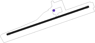
Rach Gia
Airport details
| Country | Vietnam |
| State | Kien Giang Province |
| Region | VV |
| Airspace | Ho Chi Minh Ctr |
| Municipality | Rach Gia City |
| Elevation | 5ft (2m) |
| Timezone | GMT +7 |
| Coordinates | 9.95000, 105.13333 |
| Magnetic var | |
| Type | land |
| Available since | X-Plane v10.40 |
| ICAO code | VVRG |
| IATA code | VKG |
| FAA code | n/a |
Communication
| Rach Gia Tower | 118.300 |
Nearby beacons
| code | identifier | dist | bearing | frequency |
|---|---|---|---|---|
| RG | RACH GIA NDB | 0.5 | 359° | 335 |
| RGI | RACHGIA VOR/DME | 1.3 | 55° | 115.10 |
| TRN | CAN THO VOR/DME | 34.7 | 77° | 113.20 |
| M | CANTHO NDB | 36.1 | 76° | 408 |
| QL | CA MAU NDB | 46.5 | 177° | 305 |
Departure and arrival routes
| Transition altitude | 9000ft |
| SID end points | distance | outbound heading | |
|---|---|---|---|
| RW08 | |||
| POTI1A, POTI1D | 33mi | 59° | |
| TRN1D, TRN1A | 35mi | 77° | |
| TUNP1A, TUNP1D | 33mi | 282° | |
| RW26 | |||
| POTI1B, POTI1E | 33mi | 59° | |
| TRN1B, TRN1E | 35mi | 77° | |
| TUNP1B, TUNP1E | 33mi | 282° | |
| STAR starting points | distance | inbound heading | |
|---|---|---|---|
| ALL | |||
| TUNP1C, TUNP1G, TUNP1F | 32.8 | 102° | |
| POTI1C, POTI1G, POTI1F | 33.3 | 239° | |
| TRN1F, TRN1C | 34.7 | 257° | |
Disclaimer
The information on this website is not for real aviation. Use this data with the X-Plane flight simulator only! Data taken with kind consent from X-Plane 12 source code and data files. Content is subject to change without notice.
